Bottom Line:
- The severe weather threat continues today across southwest Georgia and the Florida Panhandle and Big Bend.
- A low-end flash flood threat also continues as the line of storms slowly moves eastward.
- Dangerous beach conditions remain along all beaches
Severe Weather Threat:
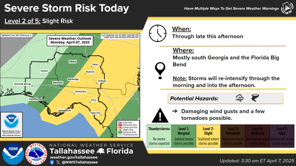
A line of thunderstorms will slowly move through the area today along a cold front. The line of storms may weaken a bit near sunrise, but it is expected to stall briefly and re-intensify this morning near the Apalachicola and Flint Rivers. Damaging winds and brief tornadoes will be the primary severe weather concerns. The Storm Prediction Center continues a Marginal to Slight Risk (level 1-2 of 5) for most of the area with the higher threat mostly over our Georgia and FL Big Bend counties.
Given the slow movement and reorganization of storms, timing is a bit difficult to pin down. Generally:
- Central Time Zone counties (except Gulf County): through 10 AM CT.
- Southwest Georgia & western Big Bend and Gulf County: 10 AM to 4 PM ET.
- I-75 Corridor and the Suwannee Valley: 2 PM to 8 PM ET.
Note that moderate rain with some embedded non-severe storms will continue for several hours behind the main line of storms.
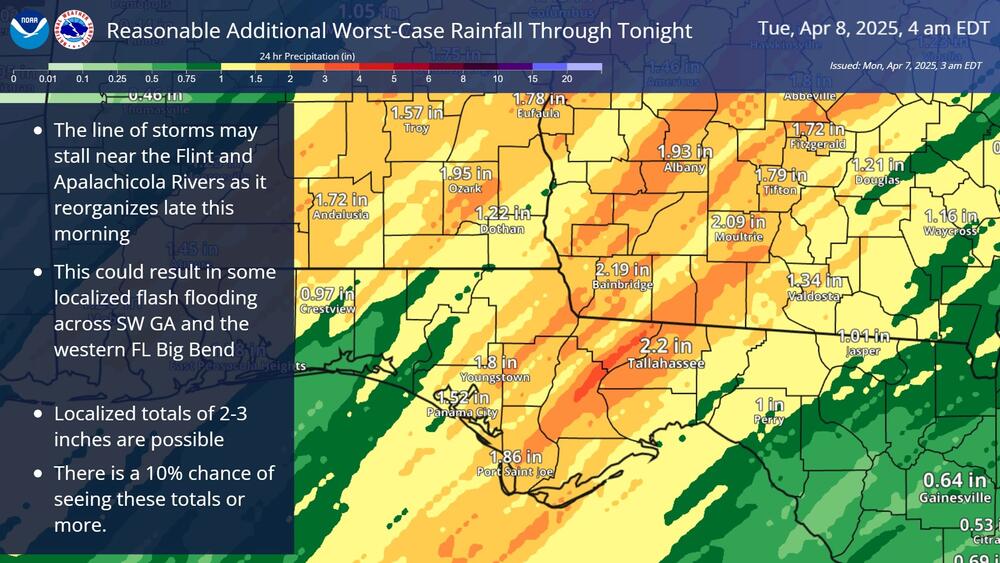
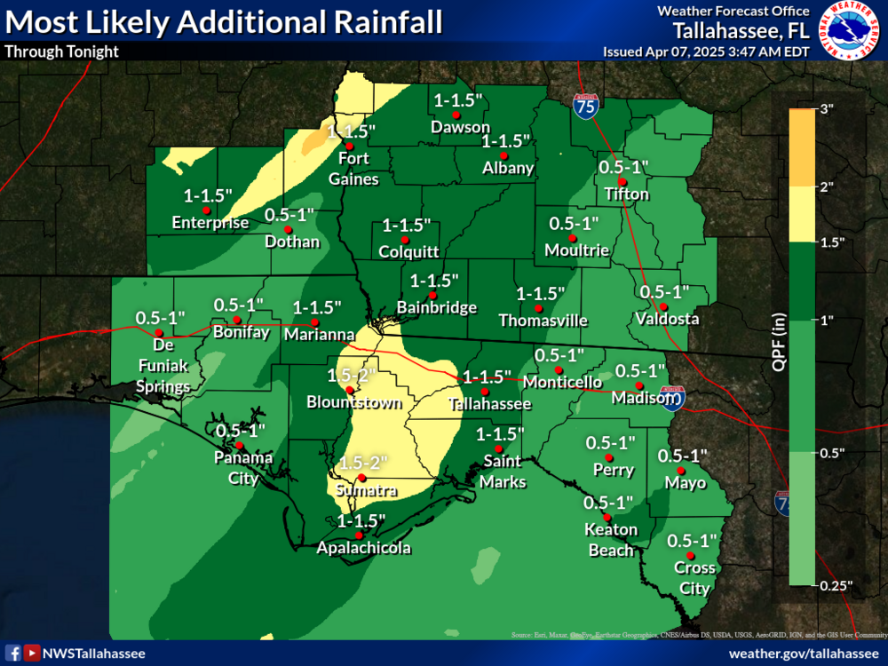
Flash Flood Threat:
The heaviest rainfall this morning will continue over southeast Alabama and the western Florida Panhandle where another 1-2 inches of rain is expected. Farther east, as the line stalls and reorganizes near the Flint and Apalachicola Rivers, another area of locally heavy rainfall is possible. This area could see 2-3 inches of rain, which if it falls in a short period of time, could lead to a localized flash flood threat. Widespread moderate rain will likely continue for several hours after the main line of storms passes.
Dangerous Beach Conditions:
While winds will be a bit lighter today, the rip current risk remains high along all of our beaches as it will take time for the surf to subside.

