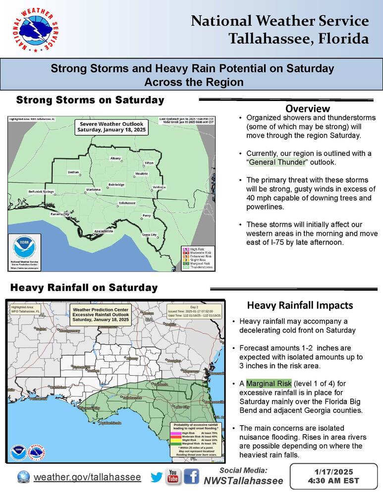
Bottom Line:
A few strong thunderstorms, along with a heavy rain threat, are expected Saturday into early Sunday morning. In the wake of the rainfall, a strong arctic cold front will move through the region ushering in the coldest air of this winter season. There is a low chance (20-30%) of wintry precipitation across portions of the region Monday night into Wednesday morning.
Overview:
Thunderstorms will move into the region Saturday morning and move to the east of the region by late Saturday afternoon. Some of these storms could be strong with strong winds being the main threat. These storms will also produce heavy rainfall, with localized heavier amounts up to 3 inches. A marginal risk (level 1 of 4) for excessive rainfall is in place Saturday and Saturday night for the Florida Big Bend counties and adjacent southwest Georgia.
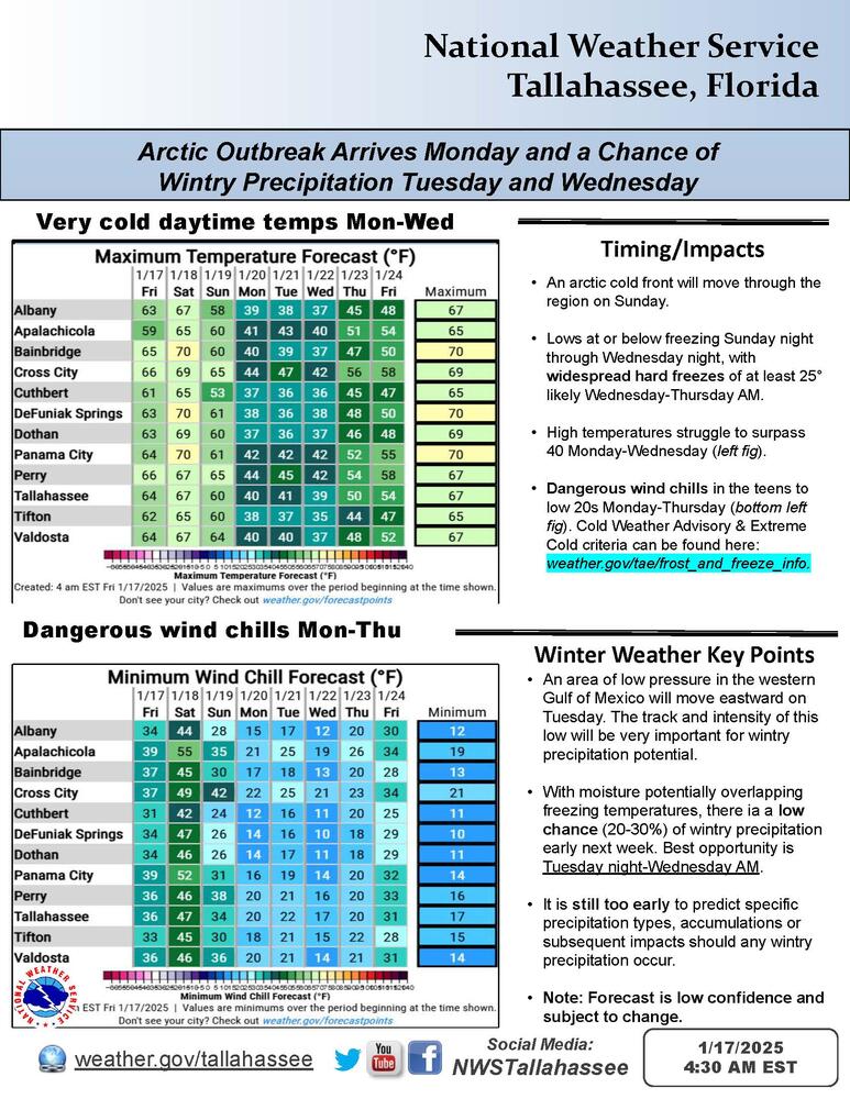
By Sunday, a strong arctic cold front will pass through the region and the coldest air of this winter season will arrive. Monday through Wednesday mornings will each feature wind chills in the teens across Southeast Alabama, South Georgia and portions of the Florida Panhandle with lower twenties elsewhere.
A low pressure system is expected to move near or just south of the region Tuesday into Wednesday. With the cold air mass in place, there is currently a low chance (20-30%) that wintry precipitation could occur across the Tri-State region. While it is too early to speculate about any accumulations given the overall low confidence in wintry precipitation for the area, please continue to monitor the forecast for updates.

