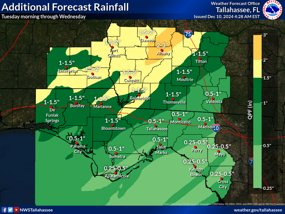
Multiple rounds of rain are forecast starting this afternoon and lasting into Wednesday morning. The heaviest rain is forecast to fall during the day tonight through tomorrow morning as a front temporarily stalls over the region. Total rainfall amounts of 1" to 3" are expected for areas along and northwest of a line from Panama City to Tifton with some amounts locally up to 4"+. There is also the potential for a few strong to severe storms ahead of the front this evening.
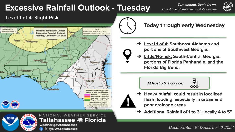
Heavy Rainfall Threat
An anomalously moist air mass for this time of year will continue to lift north into the region today and linger through tomorrow. This will result in heavy rainfall across the Florida Panhandle, southeastern Alabama and portions of southwestern Georgia with the heaviest rain likely to fall tonight through early tomorrow morning. Rainfall amounts along and northwest of a line from Panama City to Tifton will range from 1-3", tapering off to 1" or less across the Florida Big Bend and south-central Georgia.
Given the higher amounts, and a low (10-20%) chance of 4+ inches of rain across the northwestern portion of the forecast area, there is a Marginal Risk (level 1 of 4) of flash flooding concerns for the Florida Panhandle, southeast Alabama, southwest Georgia, and the westernmost Florida Big Bend.
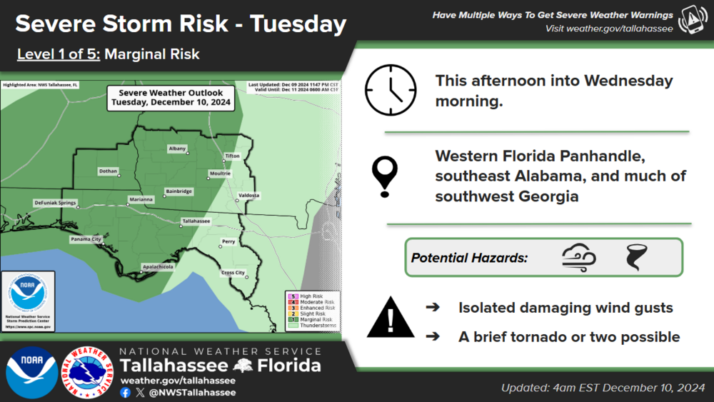
Severe Weather Threat
A severe weather threat also exists ahead of the front this evening through tomorrow morning. A Marginal Risk (level 1 of 5) has been outlined by the Storm Prediction Center (SPC) covering southeastern Alabama, the western Florida Panhandle, the westernmost Florida Big Bend, and a large portion of southwestern Georgia. The main concerns at this time are isolated strong to severe wind gusts with some of the stronger storms, though a brief tornado or two cannot be ruled out.

