Main Changes from Previous Briefing:
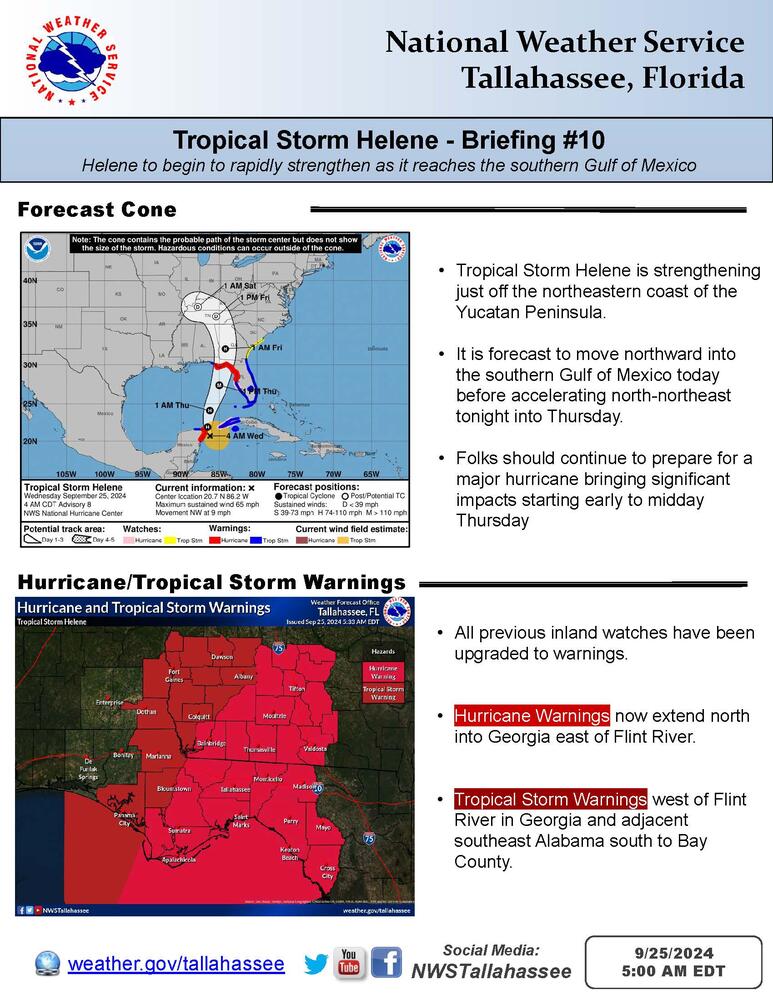
All previous inland Hurricane and Tropical Storm Watches have been upgraded to warnings this morning. Hurricane Warnings now extend from the coast from Gulf county northeast to to Worth/Turner/Ben Hill counties and counties east and south to the Florida Big Bend.
Tropical Storm Warnings encompass the remainder of the Georgia counties, Henry and Houston counties in southeast Alabama, and Jackson, Calhoun, and Bay counties in Florida. Storm surge warnings remain in place from Indian Pass to the Suwanee river.

Overview:
Tropical Storm Helene is forecast to strengthen rapidly into a major hurricane prior to making landfall along the northeast Gulf Coast Thursday evening. Significant to potentially catastrophic impacts can begin as early as midday Thursday and could last through Friday. These impacts will be amplified by the large size of the storm. Impacts include:
- Dangerous, life-threatening storm surge for Apalachee Bay
- Potentially catastrophic wind damage possible near the eventual landfall point and along the track inland.
- Strong, damaging winds further away from the center due to the storm's size.
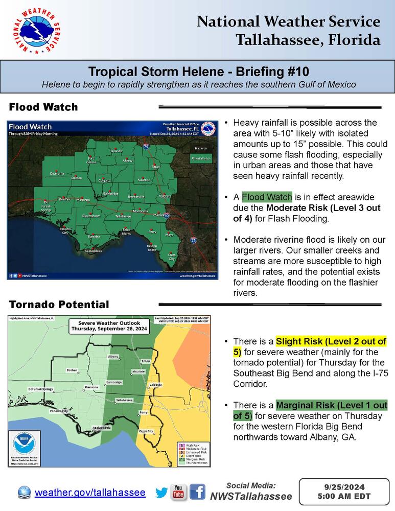
- Localized flash flooding, potentially considerable
- Minor to possibly moderate river flooding
- Extremely dangerous beach/boating conditions.
Any last minute hurricane preparations should be rushed to completion by this afternoon.