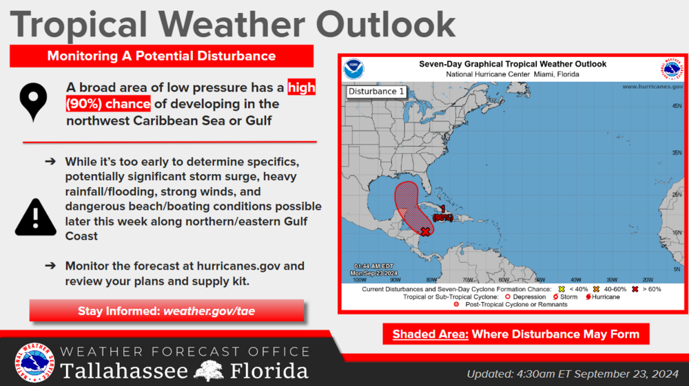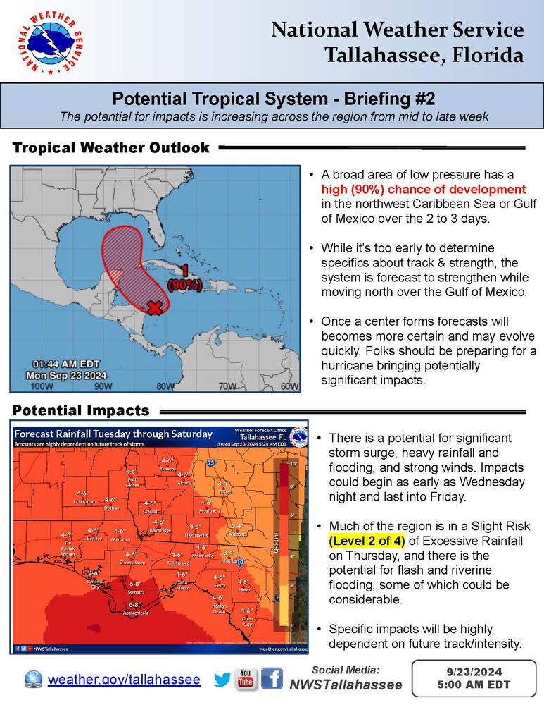
Overview:
A tropical disturbance now has a High (90%) chance of developing over the next two to three days as it moves north towards the northwest Caribbean Sea and Gulf of Mexico. The potential for impacts is increasing across the region and impacts are possible as early as Wednesday night and could last into Friday. While uncertainty in future track and intensity forecasts remain high until a center forms, overnight model guidance has come into somewhat better agreement and folks across the north and eastern Gulf should be preparing for a hurricane bringing potentially significant impacts. More details can be found in the one page briefing attached.
For hurricane preparation this week, conditions on Monday and Tuesday look quiet and mostly dry with isolated to scattered showers and storms returning to the forecast Wednesday afternoon.