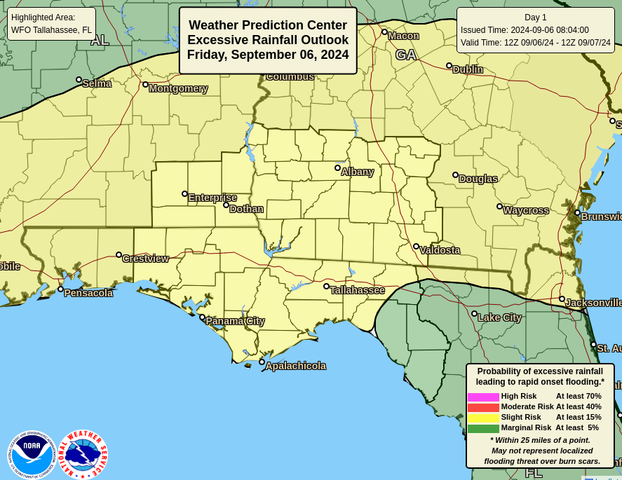
- The near-areawide Slight Risk (Level 2 of 4) of Excessive Rainfall on Friday now extends into Saturday along the Panhandle coast
- A Flood Watch is now in effect for the eastern Florida Panhandle through Saturday
- The heavy rain threat could now extend into Sunday
Bottom Line:
A multi-day heavy rainfall event is expected today through at least Saturday, and possibly into Sunday. There is a Slight Risk (Level 2 of 4) of Excessive Rainfall for most of our service area.
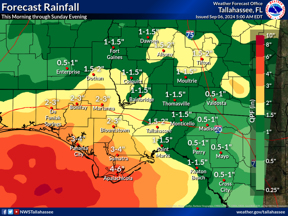
The heaviest rainfall amounts are forecast near the Panhandle coast.
Flash flooding is a concern, especially in urbanized areas near the coast.
Rivers are starting off very low, and no riverine flooding is expected.

Overview:
I-10 south to the Panhandle Coast:
- 3 to 6 inches of rain will be common through this weekend.
- A few places along the immediate Panhandle coast could get 8+ inches.
- Despite the dry antecedent conditions, torrential rainfall rates could lead to scattered flash flooding, particularly in urban areas along the coast.
Southeast Alabama, Southwest Georgia, and the FL Big Bend:
- 1.5 to 3 inches of rain will be common through the weekend.
- Localized amounts of 3 to 5 inches are possible.
- Be ready for isolated flash flooding.