Bottom Line:
A cold front is forecast to arrive Sunday afternoon into Sunday night. Strong to severe thunderstorms are possible ahead of and along the front with damaging winds the primary concern.
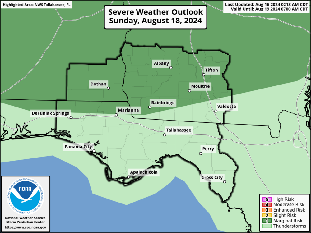
Overview:
There is a Marginal Risk (Level 1 of 5) of severe thunderstorms Sunday afternoon into Sunday night across southeastern Alabama and southwestern Georgia. A cluster of showers and thunderstorms is forecast to move through the region ahead of a cold front forecast to move through Sunday night. Damaging wind is the primary concern within any of the stronger thunderstorms with large hail also a possibility.
Confidence is low to medium at this time. The placement and timing of the thunderstorms remains uncertain as a lot of that will depend on what happens farther north across Kentucky and Tennessee Saturday into Saturday night.

