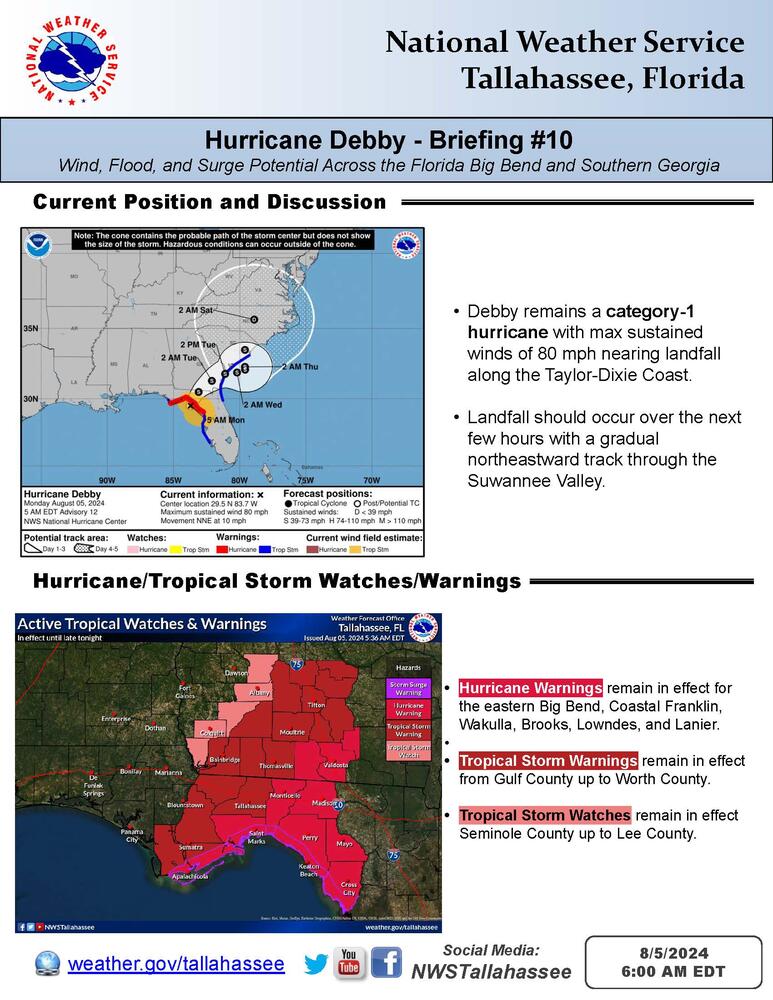
Hurricane Debby has made landfall near Steinhatchee, Florida (attached) at the Taylor-Dixie coast with max sustained winds of 80 mph.
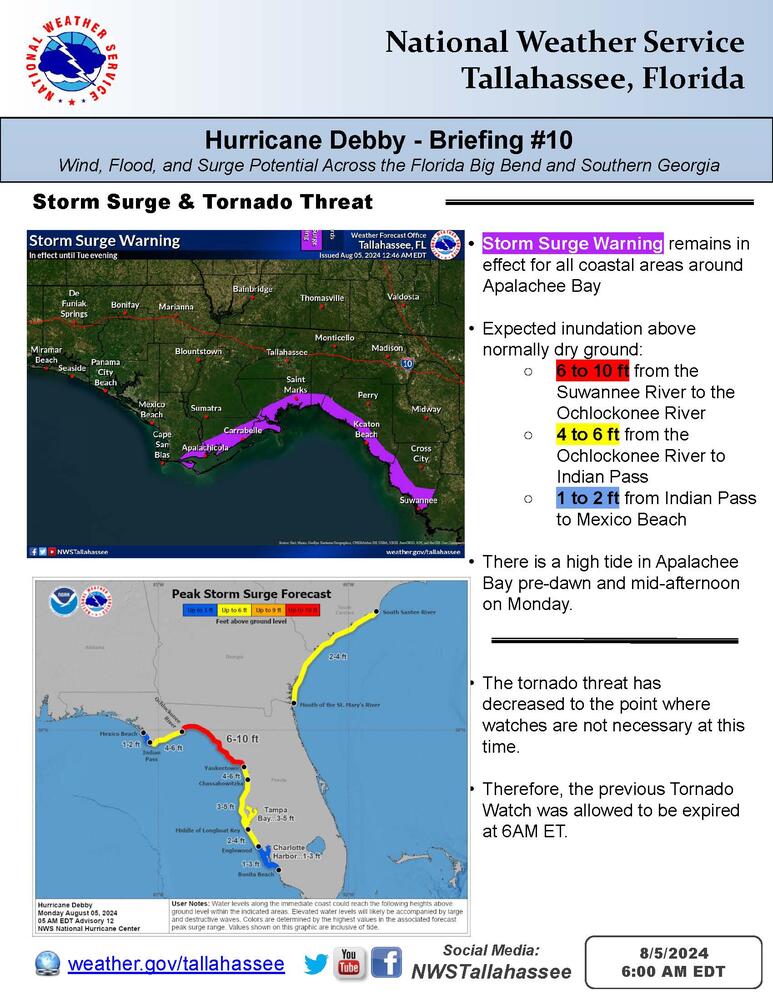
The Tornado Watch was allowed to expire at 6AM ET with no additional Tornado Watches scheduled at this time.
Forecast rain amounts have been updated: 6 to 12 inches, isolated higher.
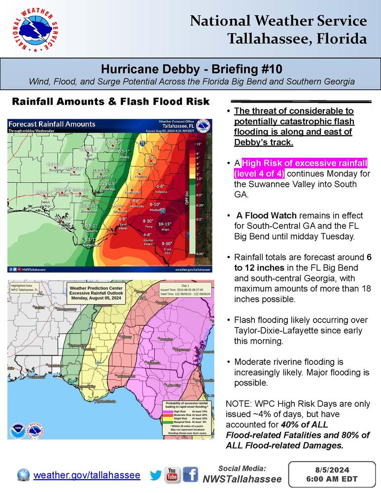
A gradual northeastward track through the Suwannee Valley inland to the FL/GA border is expected into the afternoon. The worst impacts should occur along and east of the track with heavy flooding rains being the primary concern. Flash flooding is likely occurring over Taylor-Dixie-Lafayette as of early this morning.
Attached, you'll find an updated briefing packet based on the August 5th 5 am ET advisory for Hurricane Debby. All active Tropical Watches & Warnings (including storm surge) remain unchanged. The existing Flood Watch also remains unchanged.