
- Odds of tropical depression development over the Straits of Florida or the eastern Gulf have increased and are now High (80 percent)
- The system looks more progressive, meaning that the prospect of a stalling or meandering system is much less likely. As with any tropical system, heavy rain and flooding are still threats, but a progressive system lessens the chance of measuring rainfall in feet.
Bottom Line:
There is now a high chance (80 percent) of tropical cyclone development in the Straits of Florida and the eastern Gulf this weekend. The tropical cyclone would then move northward, with the prospect of a landfall somewhere along the northeast or eastern Gulf Coast late this weekend.
Along the Big Bend coast, impacts could begin as soon as Sunday.
Tropical Storm Watches and Warnings could be required for some portion of the state of Florida later today. If tropical development does not happen sooner, then the issuance of watches and/or warnings would necessarily mean the start of advisory packages from the National Hurricane Center.
Overview:
A strengthening tropical depression or tropical storm should be moving northward near or off the West Coast of Florida on Saturday night and Sunday morning. How far north it makes landfall will depend on how soon it makes a northeast turn. Landfall is most likely along the northeast or eastern Gulf coast, roughly somewhere from Apalachicola over to the West Coast of Florida. Tropical Storm Watches and Warnings could be required for parts of Florida later today. Keep in mind that the tropical cyclone will be strengthening as it moves north, so the further north that it gets before landfall, the better of a shot that it has to possibly attain hurricane status.
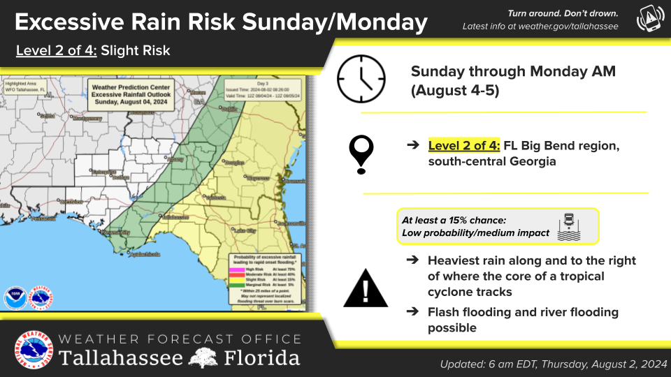
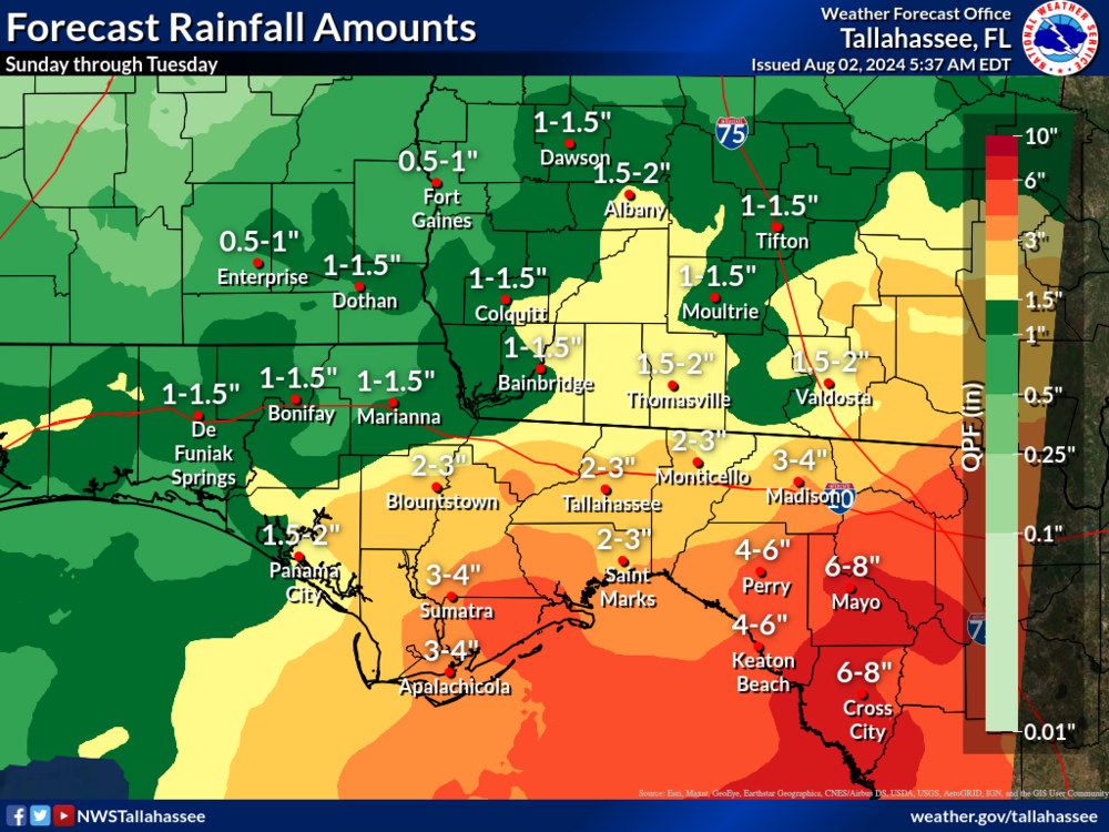
Heavy flooding rains will be a threat, mainly along and east of where the core of the system tracks.
Once National Hurricane Center advisories begin, then storm surge scenarios will start to come into focus.

