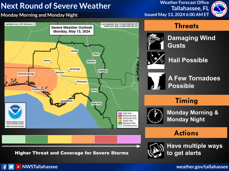
The western Florida Panhandle has been upgraded to an Enhanced Risk (3 of 5) for severe storms late this morning through tonight. The Slight Risk (2 of 5) has been expanded further east into the western Big Bend, up into Albany, GA. The eastern extent of the region is included in a Marginal Risk (1 of 5) for severe storms today.
Regarding excessive rainfall: the Slight Risk (2 of 4) expanded further east to include the western Big Bend, while the Moderate Risk (3 of 5) still is highlighted for Walton County. For Tuesday, the Slight Risk (2 of 4) was trimmed back to the FL counties with SE AL and SW GA being placed in a Marginal Risk (1 of 4).
Overview:
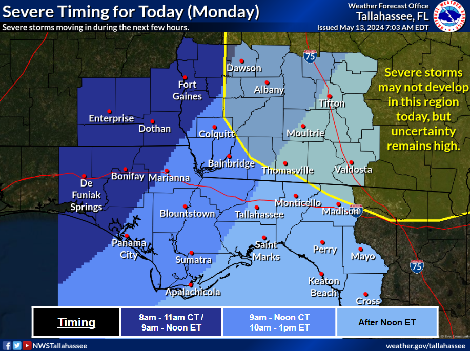
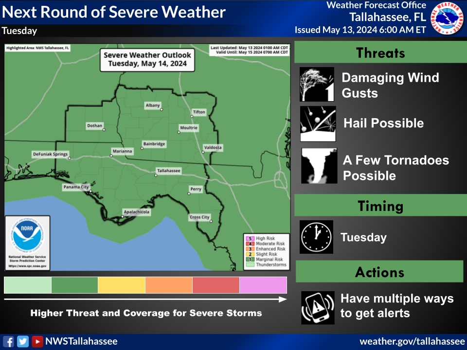
Multiple rounds of storms are expected to occur. A round of strong to severe storms is expected this morning, with a Severe Thunderstorm Watch currently in place for most of southeast AL and the western FL Panhandle through 11 AM CDT. This system is expected to continue moving to the east and southeast and work its way through the Big Bend between late morning or early afternoon. This may be followed by another round of storms in the late afternoon through the evening, and some storms may also be severe. Additionally, more storms are expected Tuesday afternoon into the evening with some severe storms possible as well.
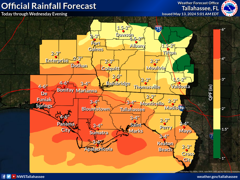
The Flood Risk remains with 2-5 inches in the forecast with isolated