Bottom Line:
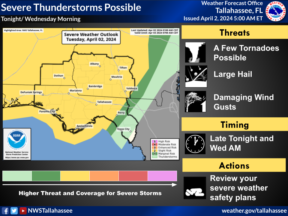
Severe thunderstorms remain possible from late tonight through Wednesday morning.
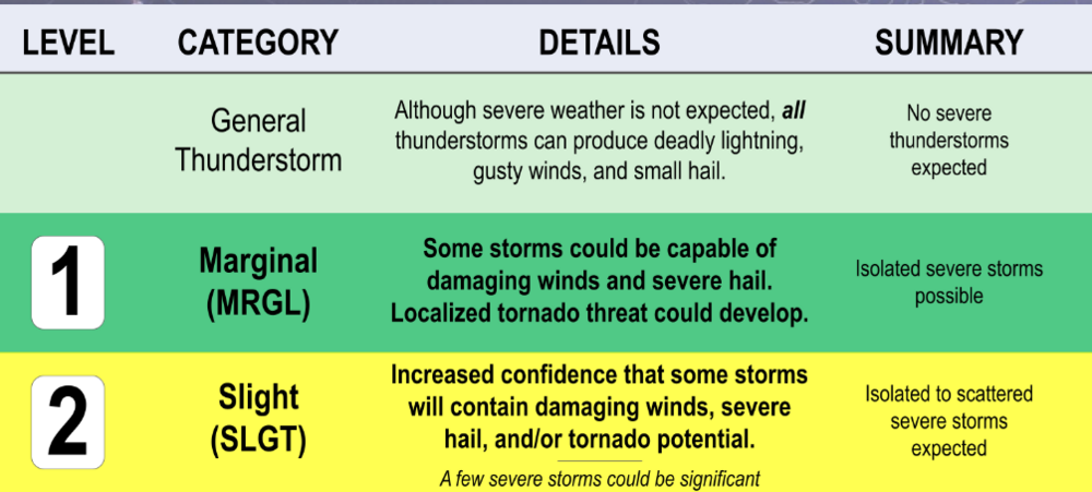
A Slight Risk (level 2 of 5) of severe storms remains in place for Southeast Alabama, the Florida Panhandle, all of Southwest Georgia, and most of the Florida Big Bend region.
All types of severe weather are possible with this event. This includes a few tornadoes, large hail, and damaging wind gusts.
Overview:
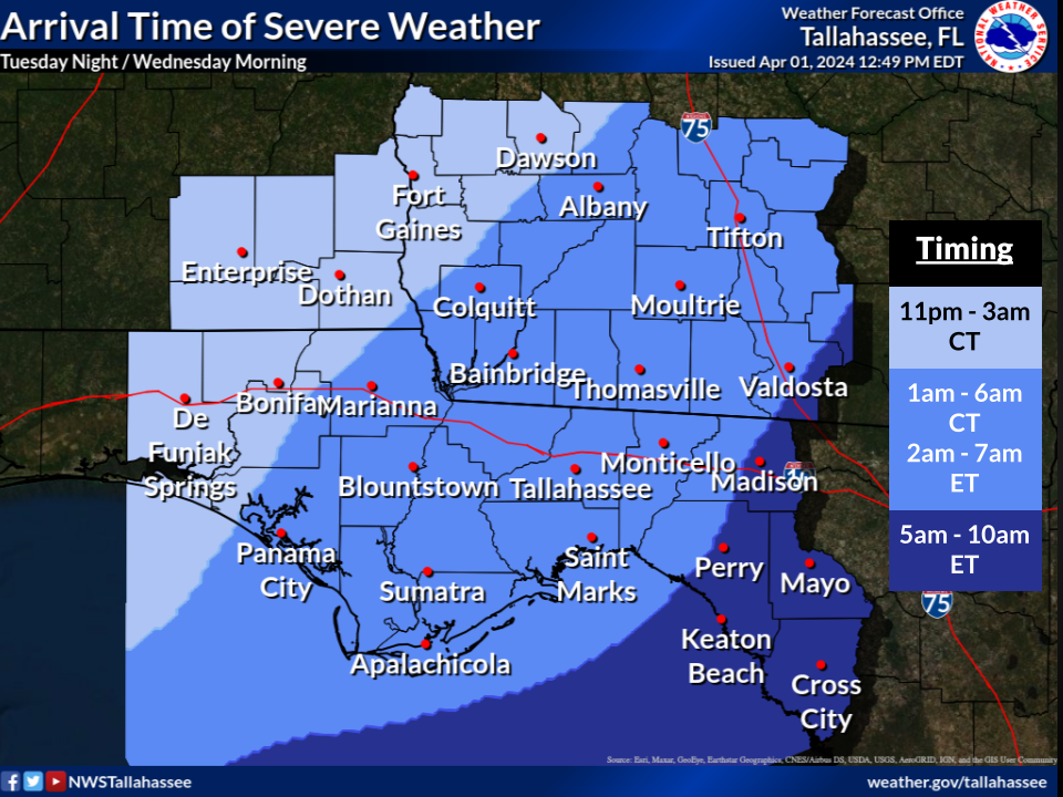
A broken line of thunderstorms will move southeast out of Central Alabama late this evening, reaching the Alabama Wiregrass sometime between late this evening and the wee hours of Wednesday morning. This line will continue to move southeast across our Georgia and Florida counties during the pre-dawn hours Wednesday morning, finally exiting past the Lower Suwannee Valley late Wednesday morning.
The line of thunderstorms will be broken, increasing potential for embedded discrete supercell thunderstorms. If the weather evolves this way, then it would increase tornado potential during the overnight hours. Some guidance shows strengthening of the line in the middle of the night as it passes across Southwest Georgia and the Florida Big Bend region.
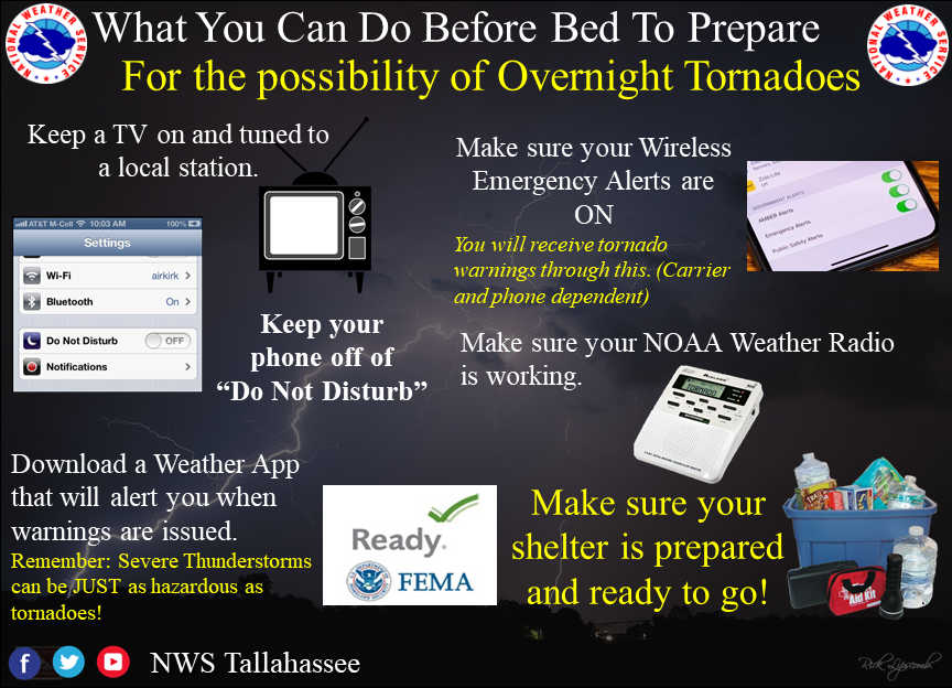
We'll want to message this as a nighttime severe weather event that includes possible tornadoes. It will be important to stress people having multiple ways to get warnings, including ways that will wake you up at night. Some additional messaging graphics are attached.