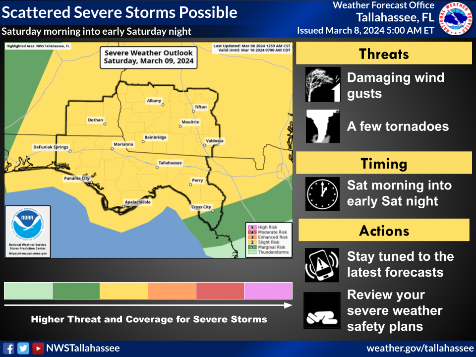
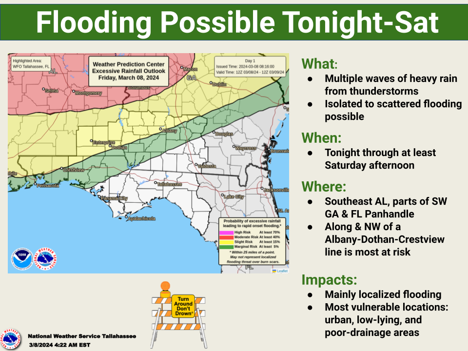
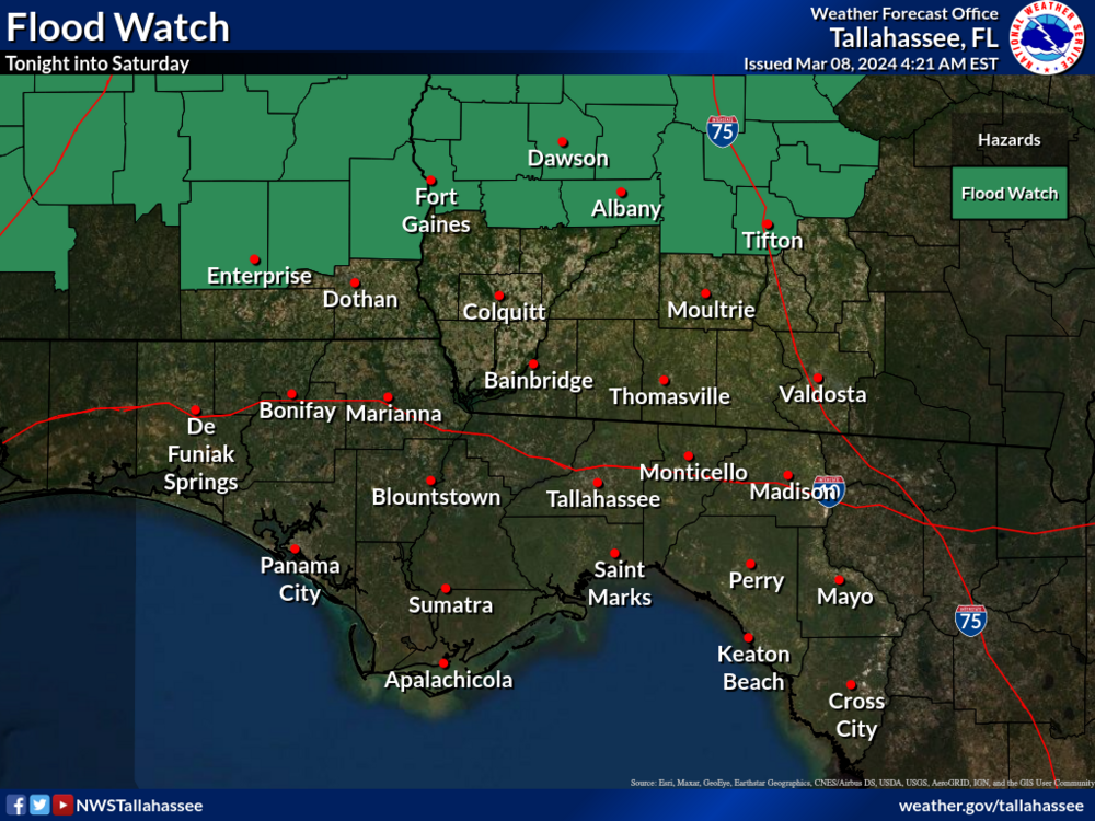
The potential for strong to severe thunderstorms continues from tonight into Saturday. Damaging winds and a few tornadoes are possible. In addition, a flood watch has also been issued for portions of southeast Alabama and southwest Georgia due to the potential for flash flooding from multiple rounds of thunderstorms tonight into Saturday.
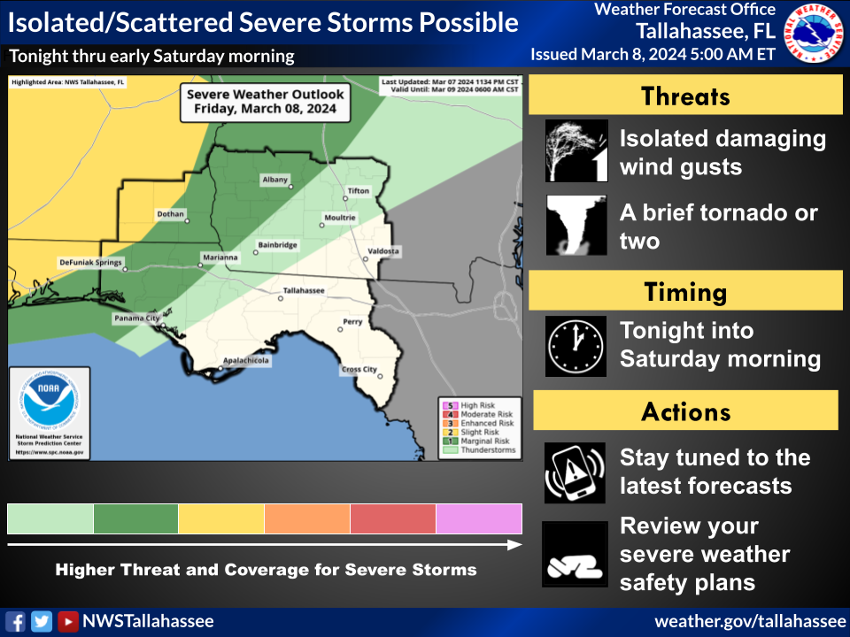
Tonight thru Early Saturday Morning prior to 7 am ET:
- Slight Risk (level 2 of 5)of severe weather
- Slight Risk (level 2 of 4)of Excessive Rainfall
Saturday morning after 7 am ET through the day
- Slight Risk (level 2 of 5)of severe weather
- Marginal Risk (level 1 of 4)of Excessive Rainfall
- Overview
An area of low pressure will develop to our west and will slowly move east to northeast today. Showers and thunderstorms are expected to move in tonight and then continue through the day on Saturday. Damaging wind gusts are the main threat with a few tornadoes also possible. Pockets of heavy rain are also likely with the heaviest amounts expected to fall in southeast Alabama and southwest Georgia within the area outlined by the flood watch. Localized amounts of 3 to 5 inches in a short period of time may lead to instances of flash flooding in those areas.

