Changes since Wednesday morning:
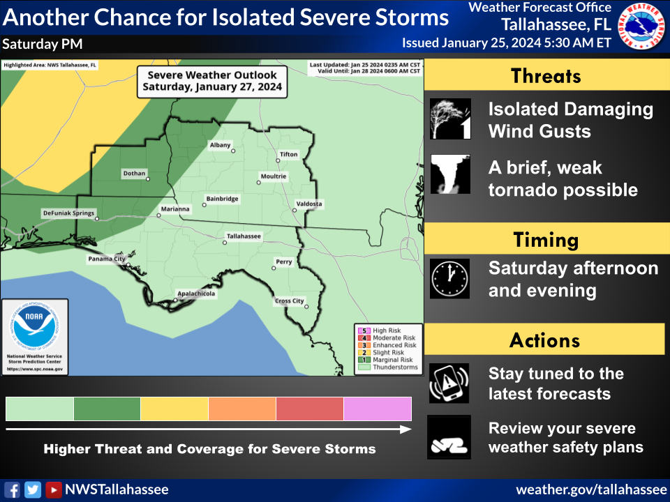
- The convective outlook has lowered Saturday's risk level for most of Southeast Alabama and western Georgia from a Slight Risk to a Marginal Risk.
- Timing of Saturday's storms has been delayed until Saturday Evening. (In this case, the delayed timing into cooler nighttime hours will reduce instability. Therefore, the Slight Risk has shifted westward toward Central Alabama, where there will be lingering instability from afternoon heating. All but Coffee County is now left with a Marginal Risk.)
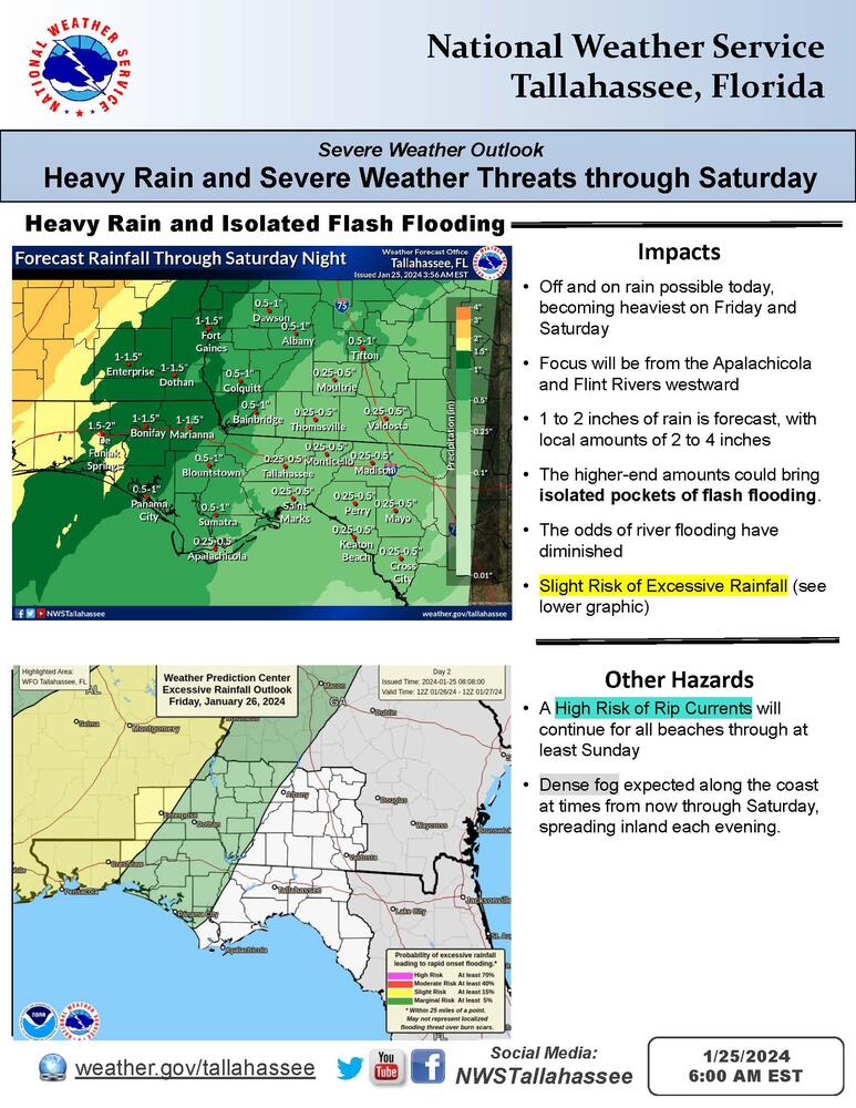
- Forecast rainfall is down a little. This further increases the likelihood of rivers remaining within their banks and staying below minor flood.
Bottom Line:
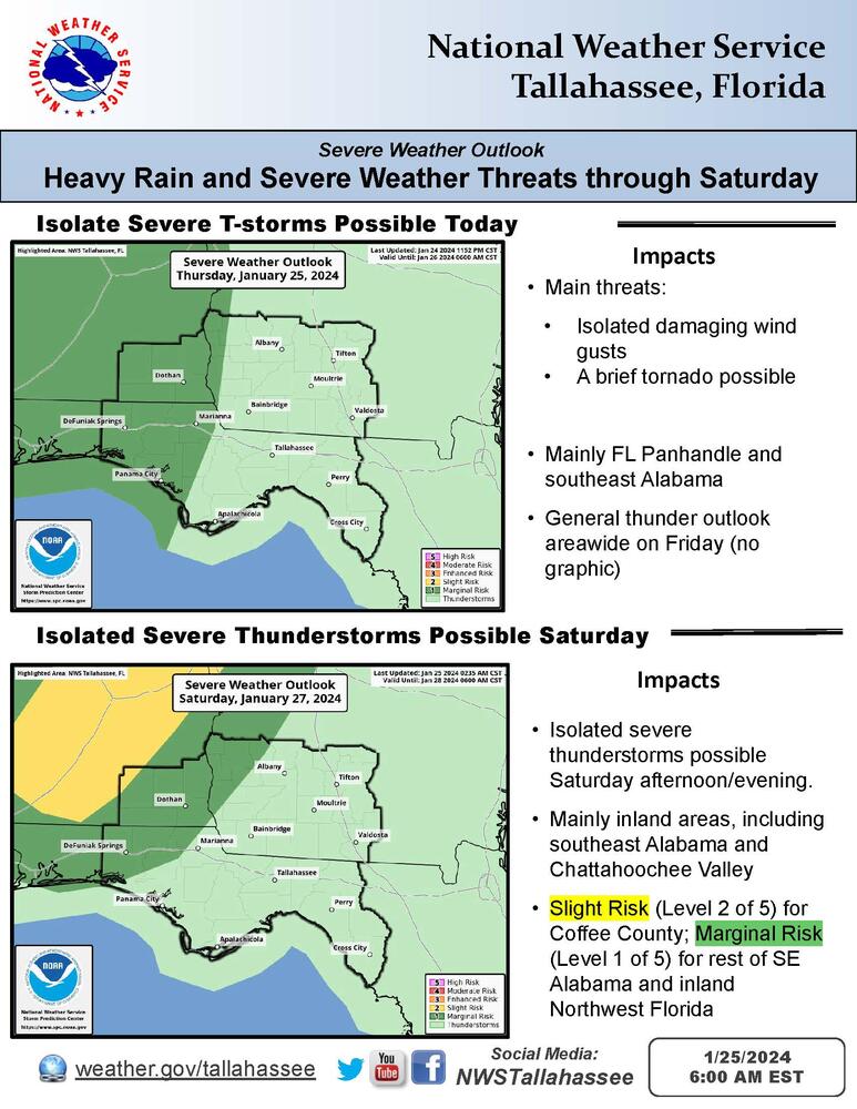
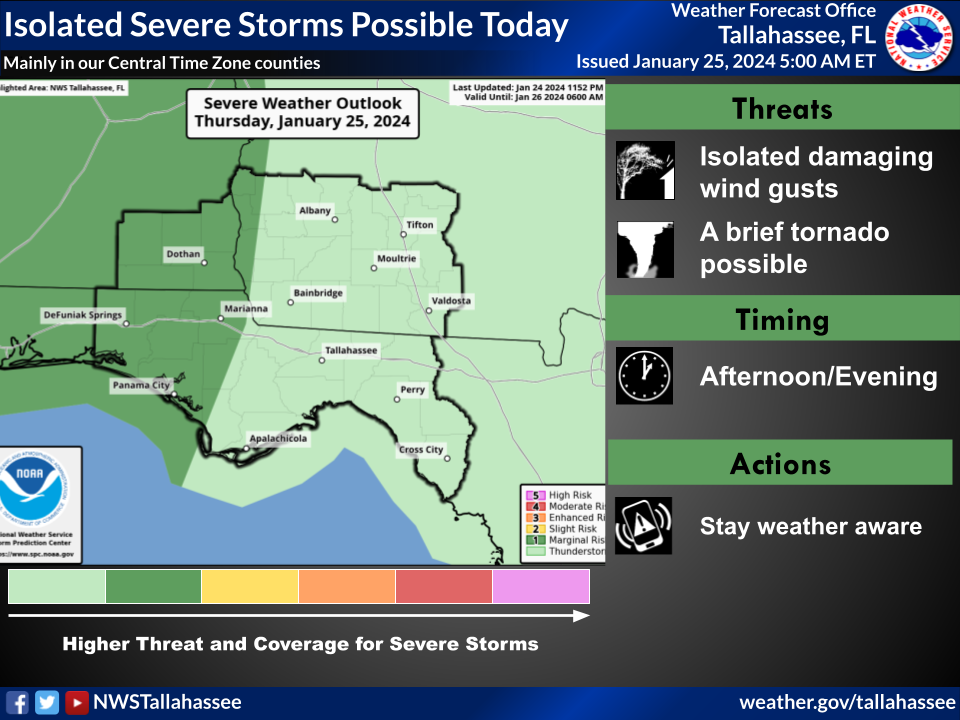
- Isolated Severe Thunderstorms are possible this afternoon over the Florida Panhandle and Southeast Alabama. There is a Marginal Risk (Level 1 of 5) of severe thunderstorms today.
- Isolated Severe Thunderstorms are possible late Saturday afternoon into the evening, mainly over Southeast Alabama, inland Northwest Florida, and parts of Southwest Georgia. Coffee County holds onto a Slight Risk (Level 2 of 5) of severe thunderstorms. For the rest of Southeast Alabama, inland Northwest Florida, and parts of Southwest Georgia, there is a Marginal Risk (Level 1 of 5) of severe storms, roughly along and northwest of a line from Fort Walton Beach, FL, to Dawson, GA.
- Isolated pockets of flash flooding are possible, mainly from now through Friday night, along and west of the Apalachicola and Flint Rivers. There is a Slight Risk (Level 2 of 4) of Excessive Rainfall.
Other Hazards Include:
- A High Risk of Rip Currents at all beaches through at least Sunday.
- Dense Fog from now through Saturday, especially along the coast.

