Changes Since Sunday Evening:
- Storm Prediction Center has expanded the Enhanced Risk of Severe Weather (Level 3 of 5)to now include the I-75 corridor of south Georgia and the Suwannee Valley of Florida
- Rainfall forecast has decreased enough to remove mention of Moderate riverine flooding from this briefing. (Minor riverine flooding is still possible.)
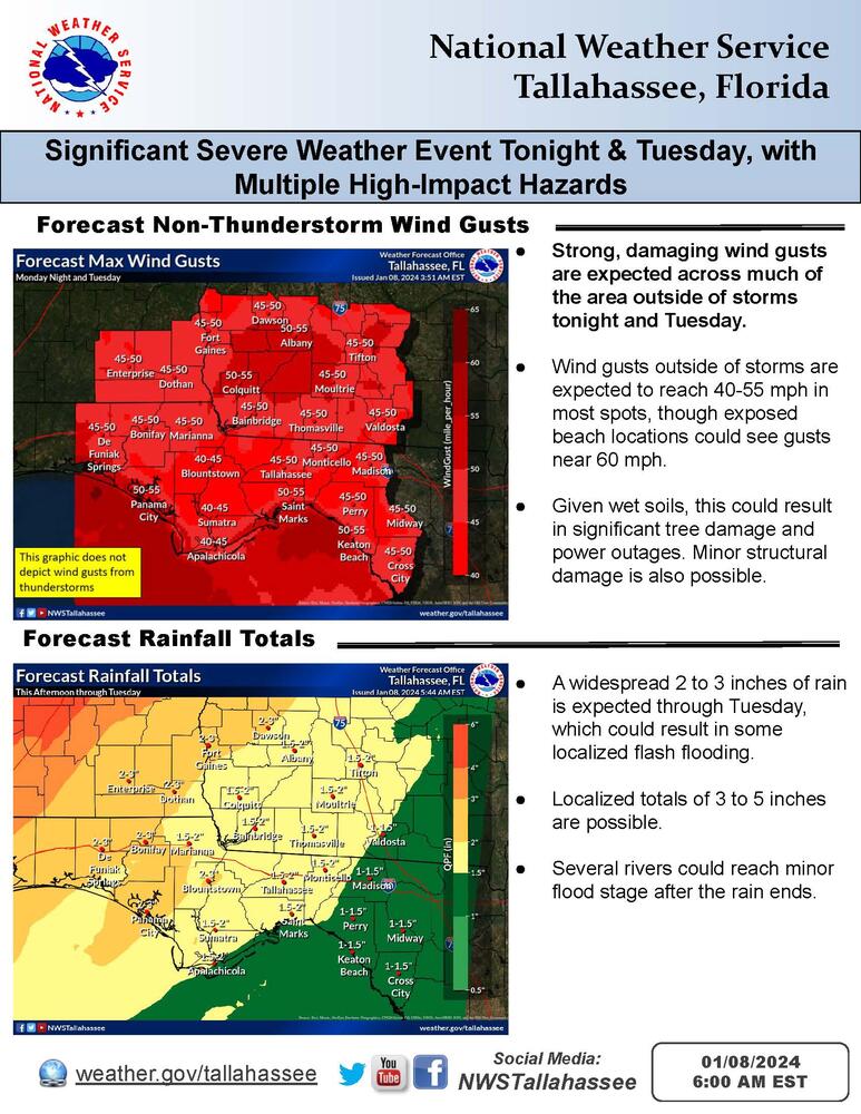
- Storm Watches and Gale Watches have been upgraded to warnings
- High Wind Warnings and Wind Advisories have been issued
- High Surf Warnings and Advisories have been issued
Summary:
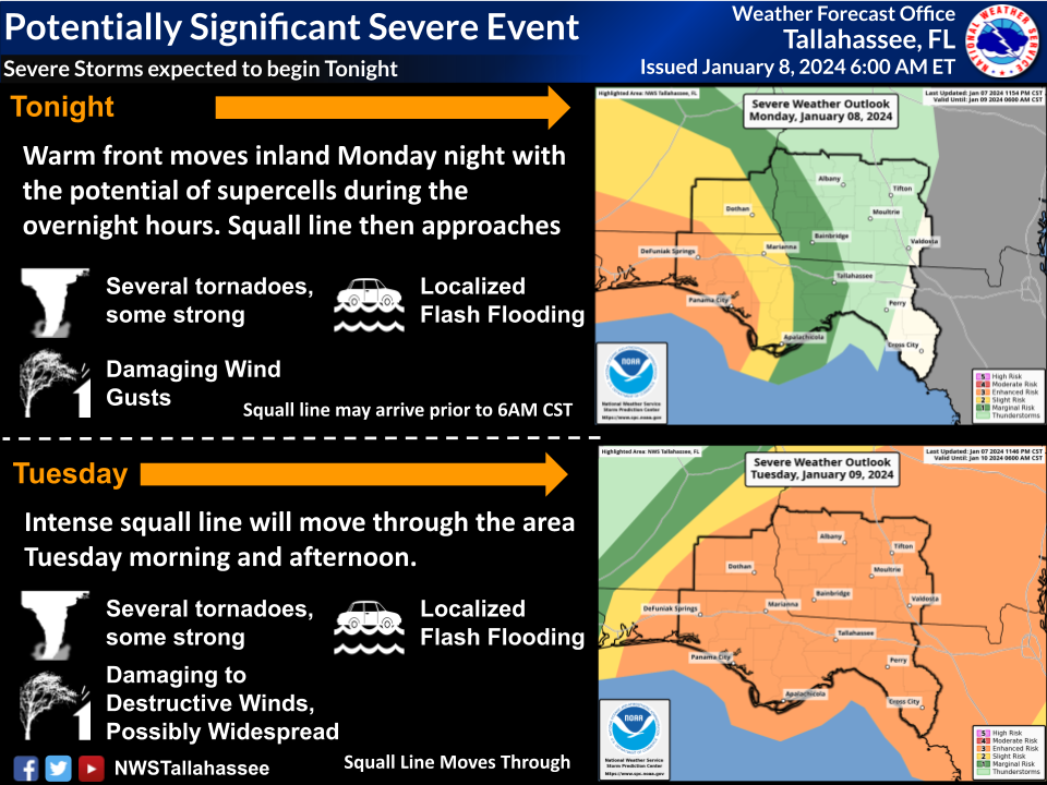
A significant high-impact and severe weather event will affect the region tonight and Tuesday. See the attached Briefing Packet and severe thunderstorm timing graphics for more details.
Impacts will include:
- Severe Thunderstorms.There's an Enhanced Risk (Level 3 of 5) of severe thunderstorms for the entire service area. Outlook and timing graphics attached. Severe modes:
- o Strong tornadoes possible
- o Damaging to Destructive wind gusts
- o Large Hail
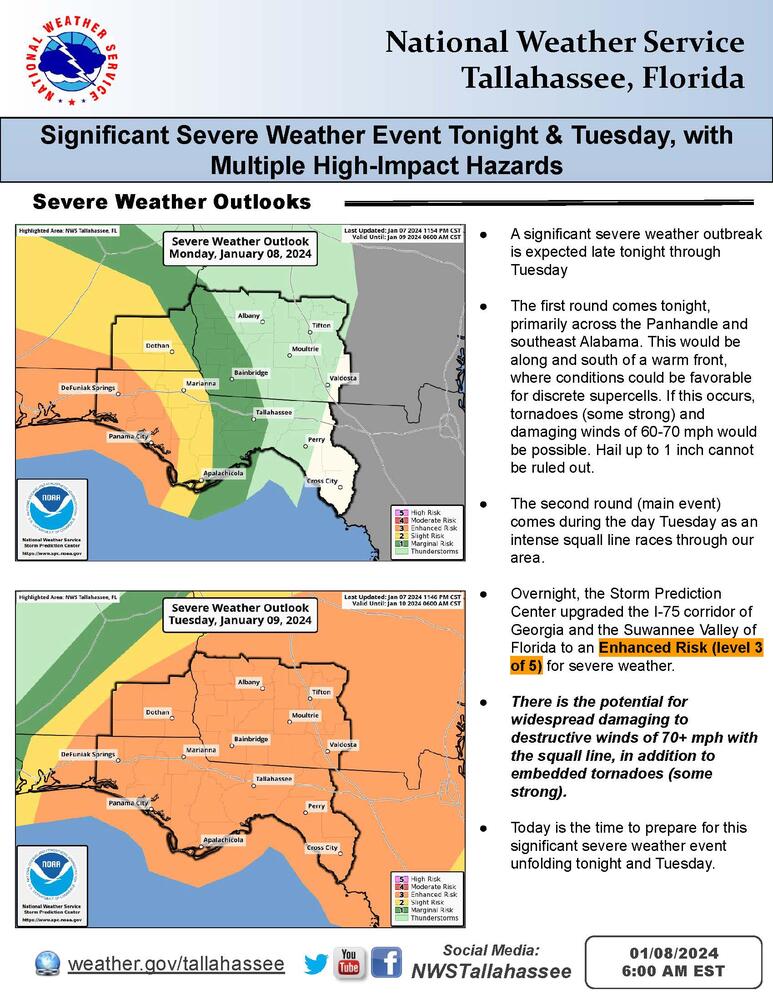
- Strong, damaging general winds(outside of thunderstorms)
- Pockets of Flash Flooding, including rapid rises on creeks and streams. There's a Slight Risk (Level 2 of 4) of Excessive Rainfallover the Panhandle and the Alabama Wiregrass.
- Minor river floodingin many river systems in the days following heavy rain.
- Minor to moderate coastal floodingaround Apalachee Bay on Tuesday.
- Life-threatening High Surf.Beach Erosion.
- Marine Hazards: Solid gale-force winds (34+ knots) with storm-force gusts (48+ knots)