Two more weather systems will affect the region over the next 7 days. Both systems bear watching, but the system on Monday night and Tuesday has potential to be a significant severe weather event, plus other impacts too.
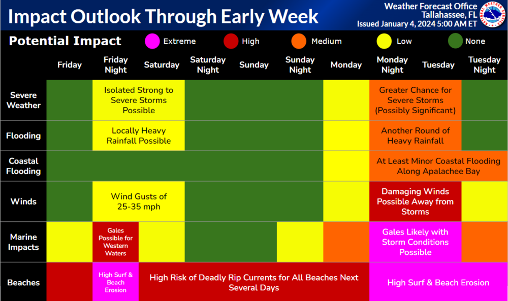
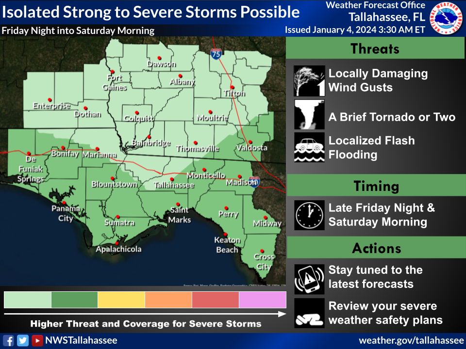
#1: Friday night/Saturday:
- Isolated Severe Storms Possible, especially for coastal communities. Main threats: locally damaging wind gusts and a couple tornadoes. Marginal Risk (Level 1 of 5) of severe storms (see graphic).
- Life-threatening high surf at the beaches
- 1-2 inches of rain, locally 3 inches. Local runoff issues possible.
- Gales likely over the Gulf waters
#2: Monday night/Tuesday: This could be a significant event
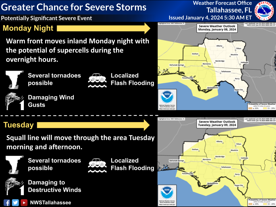
- Odds are increasing for a significant severe weather event. All modes of severe weather are possible, including:
- o Several tornadoes,
- o Damaging gusts, and
- o Hail.
- o Storm Prediction Center has expanded the area covered by its 15+ percent chance on Monday night, and it has added most of our service area to the severe weather outlook for Tuesday. The 15+ percent chance area corresponds to a Slight Risk (Level 2 of 5) of severe thunderstorms (see graphic). As certainty in timing and geographic placement grows, there is room to eventually get a targeted upgrade to the risk level.
- Damaging gradient winds, i.e. winds outside thunderstorms
- 2-3 inches of rain, locally 4+ inches. Minor river flooding and isolated Flash Flooding possible.
- Solid gale-force winds (34+ knots) expected over the Gulf. Storm-force gusts (48+ knots) possible.
- Coastal Flooding likely
- Life-threatening High Surf expected. Beach erosion possible.
The system early next week (Monday night/Tuesday) is of greatest concern. Agreement among numerous models has been unusually strong. Therefore, confidence in the forecast is higher than normal, even at 5 days out.

