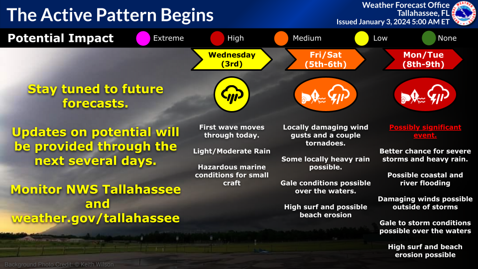
Three weather systems will affect the region over the next 7 days, each with greater impacts than the last.
#1: Today/Tonight:
- Marine Impacts
- 1 inch or less of rain
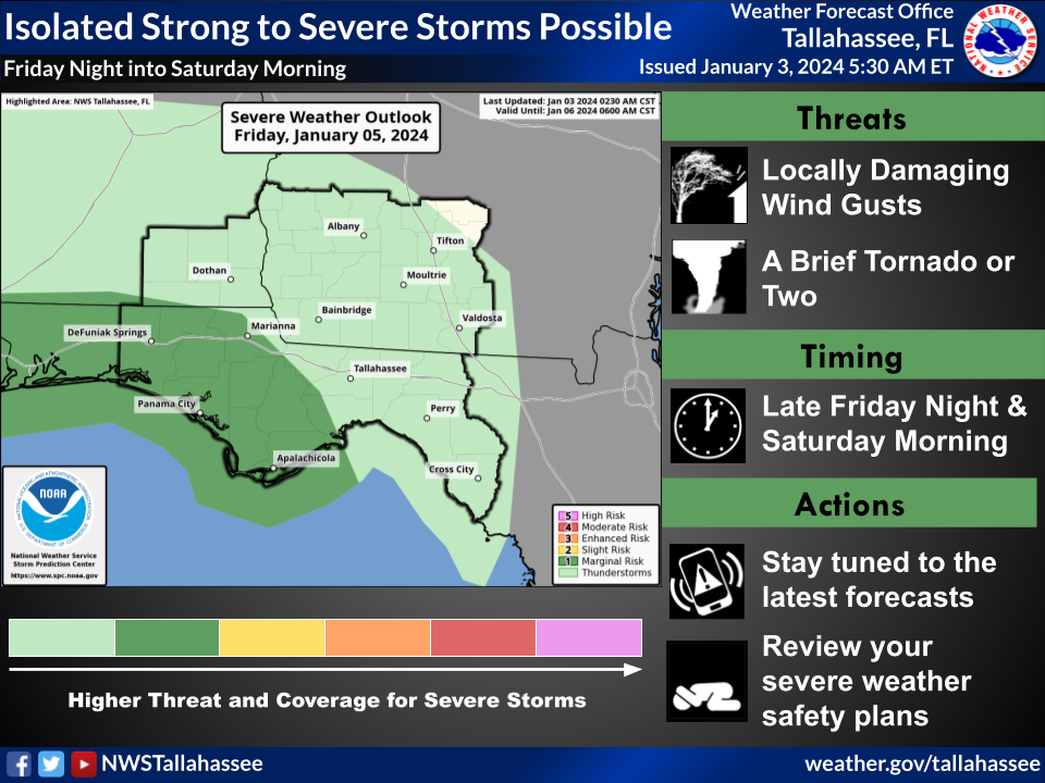
#2: Friday night/Saturday:
- Isolated Severe Storms Possible, mainly for coastal communities. Main threats: locally damaging wind gusts and a couple tornadoes. Marginal Risk (Level 1 of 5) of severe storms (see graphic).
- Life-threatening high surf at the beaches
- 1-3 inches of rain. Local runoff issues possible.
- Gales possible over the waters
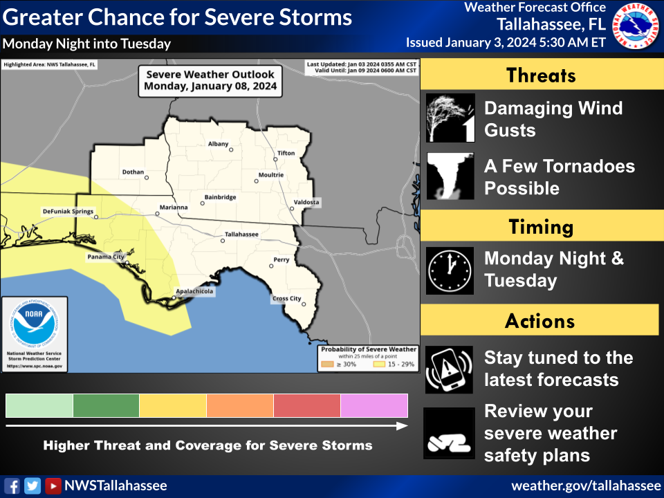
#3: Monday night/Tuesday: This could be a significant event
- Possibly significant severe weather event. All modes of severe weather possible, including a few tornadoes, damaging gusts, and hail. SPC took the uncommon step of including a 15+ percent chance area in their Day 6 severe weather outlook. This corresponds to a Slight Risk (Level 2 of 5) of severe thunderstorms (see graphic). As certainty grows, there is room for an upgrade to the risk level.
- Damaging gradient winds, i.e. winds outside thunderstorms
- 2-4 inches of rain: Minor river flooding and isolated Flash Flooding possible
- Gale-force winds likely over the Gulf, Storm-force winds possible
- Coastal Flooding possible
- Life-threatening high Surf and beach erosion
The system early next week (Monday night/Tuesday) is of greatest concern. Agreement among numerous models has been unusually good in resolving this storm and sticking with a story. Therefore, confidence in the third system is higher than normal, considering it is still 6 days out.

