Bottom Line:
A wet and unsettled weather pattern is expected across the Tri-State area, beginning on Friday and persisting through the weekend. Isolated heavy rain and severe weather are possible. Cooler and drier conditions are forecast for at least the first half of next week.
Overview:
An approaching frontal system will bring returning chances for showers and thunderstorms starting on Friday. The airmass is expected to rapidly moisten ahead of the front with the environment supportive of a severe weather and heavy rainfall threat:
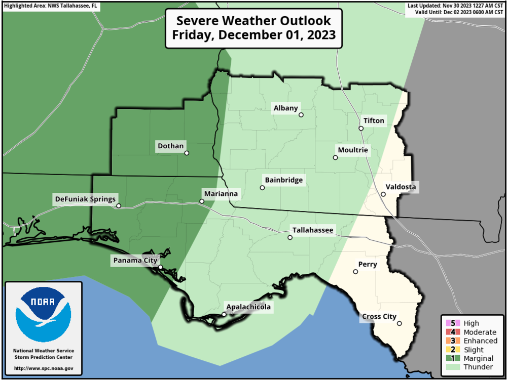
Severe weather - A Marginal Risk (level 1 of 5) is in place for Southeast Alabama and the Florida Panhandle from 7AM EST Friday to 7AM EST Saturday. The main threats are isolated damaging wind gusts and perhaps a tornado or two. Severe weather concerns spill over into Saturday as the front sags further into and stalls across the region. Locations roughly along/northwest of a Bay-Gadsden-Berrien County line are under a Marginal Risk in the Day 3 Outlook - 7AM EST Saturday to 7AM EST Sunday.
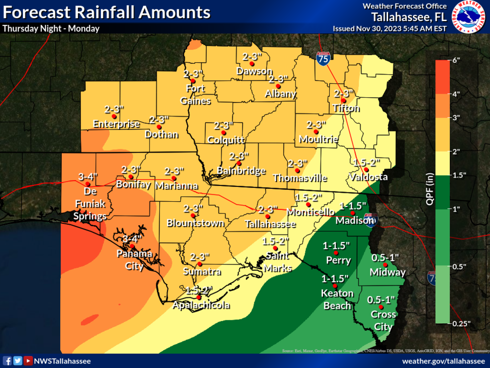
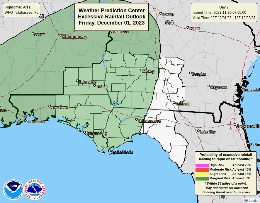
Heavy rainfall - Marginal Risks (level 1 of 4) for excessive rainfall are in place for much of the Tri-State area on Friday and Saturday. Multiple rounds of on/off precipitation are expected with potential for training showers/thunderstorms moving over the same locations repeatedly. Isolated flooding is possible, especially in urban, low-lying, and poor-drainage areas. Current forecast amounts from Thursday night through Monday are widespread 2-3+ inches (isolated higher) mainly along/west of the Flint River. The western FL Panhandle shows 3-4 inches. Values are subject to change in subsequent forecasts.

