Bottom Line:
Impactful weather is expected through mid-week and the upcoming weekend. Cold temperatures are forecast Wednesday & Thursday mornings when frost and freeze conditions are likely. Attention then turns to a wet, unsettled pattern Friday through Monday.
Overview:
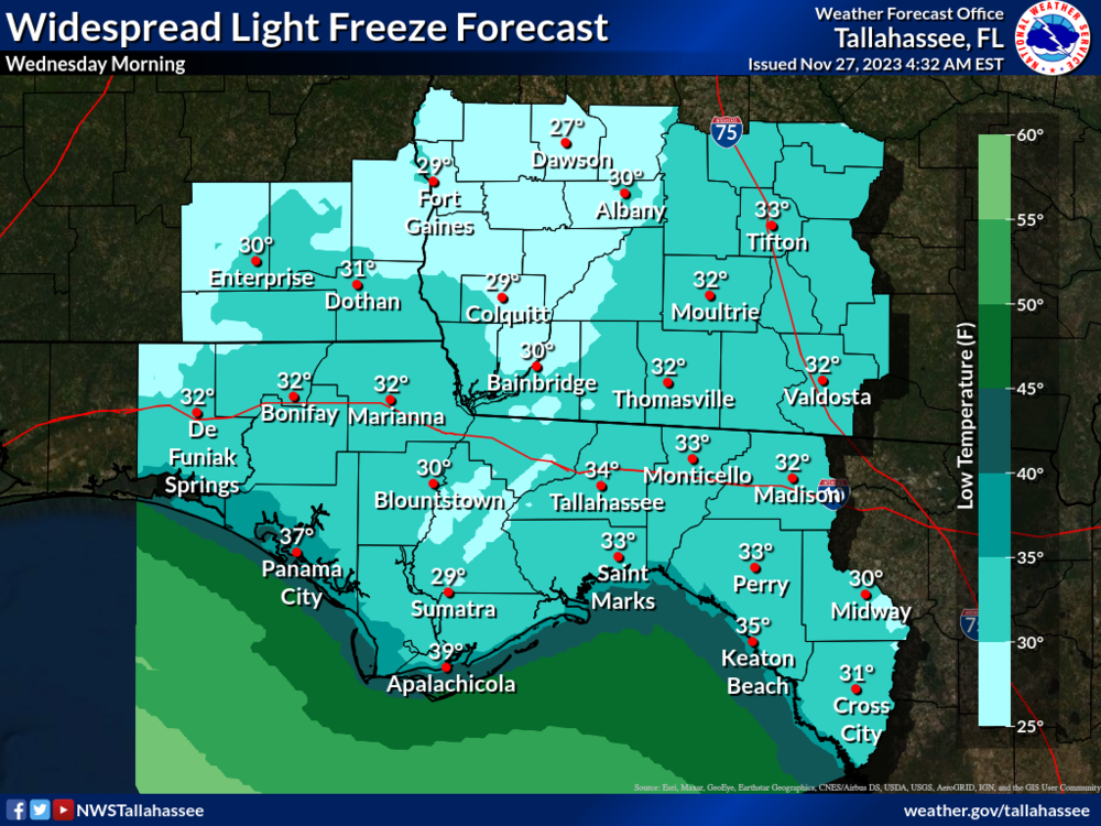
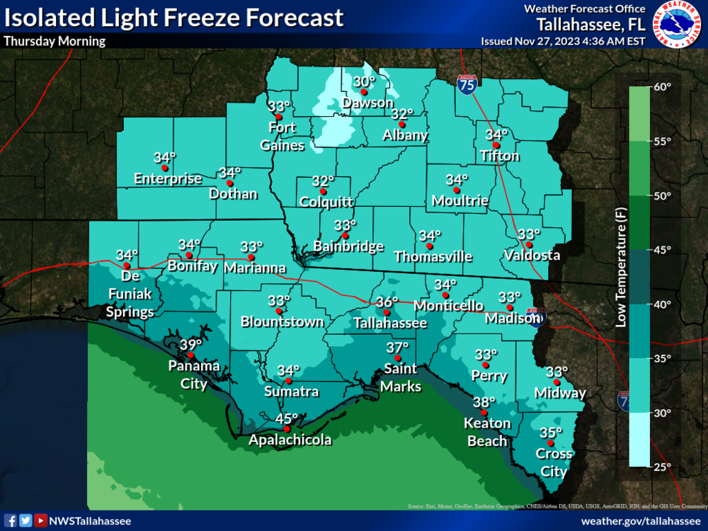
A widespread light freeze is likely Wednesday morning away from the immediate coast with patchy to areas of frost possible. Chilly temperatures in the 30s are on tap for Thursday morning, though light freezes are forecast to be more isolated. Frost may return, but confidence was not high enough to explicitly mention. Such conditions raise sheltering concerns for sensitive groups. A Freeze Watch could be issued as soon as this afternoon if trends continue.
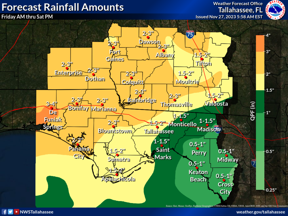
Rain chances increase on Friday from an area of low pressure passing through the Lower Mississippi Valley. The Day 5 Outlook by the WPC highlights the FL Panhandle and parts of Southeast AL with a Marginal Risk (level 1 of 4) for excessive rainfall - valid Friday AM to Saturday AM. Isolated flooding may occur. More rounds of rain are likely this weekend from additional waves of disturbances, thus making for unsettled weather until Monday. Current forecast amounts are widespread 1-3 inches (isolated 4"+) from Friday AM through Saturday PM.