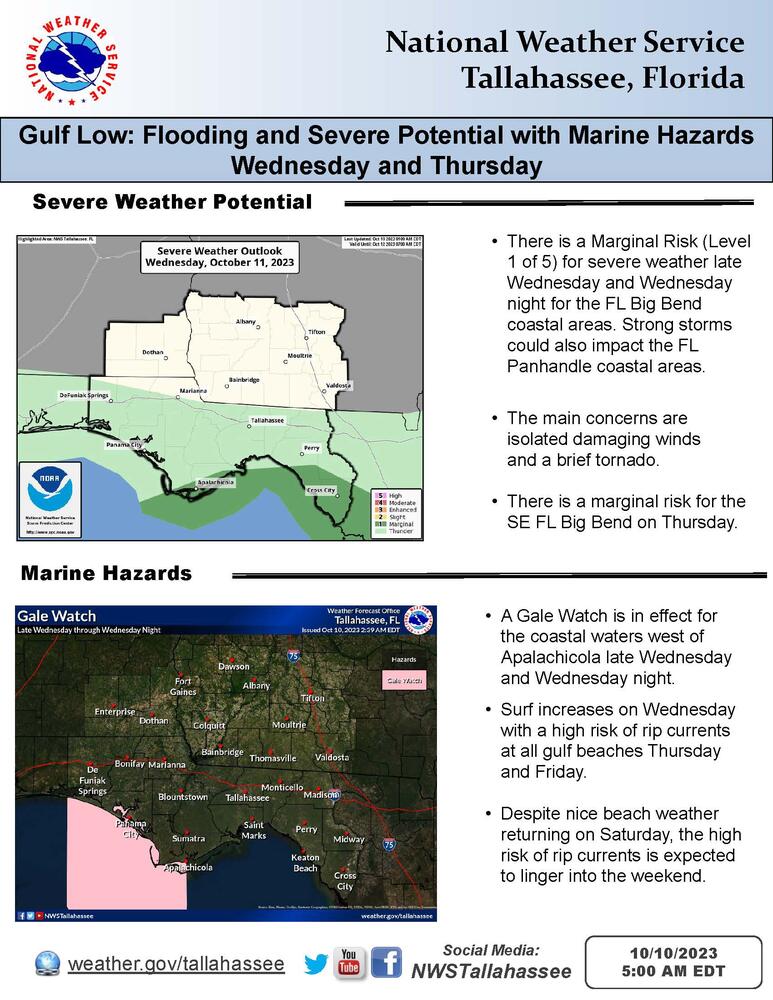
Changes: There is now a Marginal Risk of severe thunderstorms (Level 1 of 5) late Wednesday into Wednesday night for the FL Big Bend coastal areas.
Bottom Line:
A low pressure system developing in the Gulf of Mexico is expected to impact the region with heavy rainfall, the potential for severe weather, and beach/marine hazards beginning Wednesday. NHC has noted a Low (20%) chance of development with this system, before it merges with a frontal system by midweek, so we expect impacts similar to a cold season gulf low.
Details:
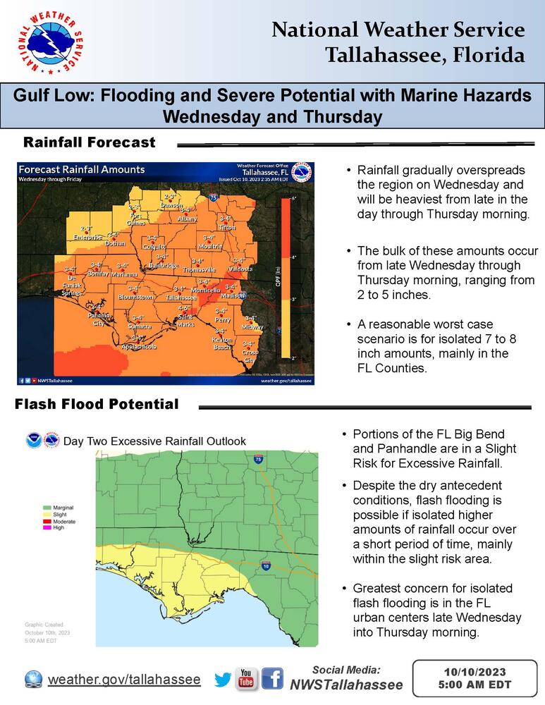
The heaviest rainfall is expected from late Wednesday into Thursday morning. There is a Slight Risk (Level 2 of 4) for excessive rainfall in portions of the FL Big Bend and Panhandle, where localized higher amounts of rain over a short period of time could lead to flash flooding despite the dry antecedent conditions, with the greatest concern in the urban centers.
There is also a Marginal Risk of severe thunderstorms (Level 1 of 5) late Wednesday into Wednesday night for the FL Big Bend coastal areas, where isolated damaging winds and a brief tornado are possible. Strong storms could also impact the FL Panhandle coastal areas during this time frame.
A Gale watch is in effect for the coastal waters west of Apalachicola from late Wednesday into Wednesday night. The rip current risk is expected to increase to high for all gulf beaches on Thursday. Despite nice beach weather returning on Saturday, the high risk of rip currents is expected to linger into the weekend.

