Bottom Line:
A period of dangerous heat continues through early next week. Maximum Heat index/apparent temperature values are forecast between 108 to 115 degrees today, and between 112 to 118 tomorrow across the tri-state region. The Storm Prediction Center has placed portions of the region in a Marginal Risk (Level 1 of 5) for severe weather today, and portions within a Slight Risk (Level 2 of 5) on Tuesday. Isolated damaging wind gusts are the primary threat both days. The Weather Prediction Center has placed much of the region in a marginal risk for excessive rainfall on Tuesday, with isolated flash flooding possible.
Overview:
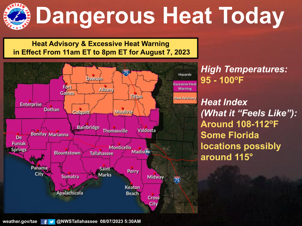
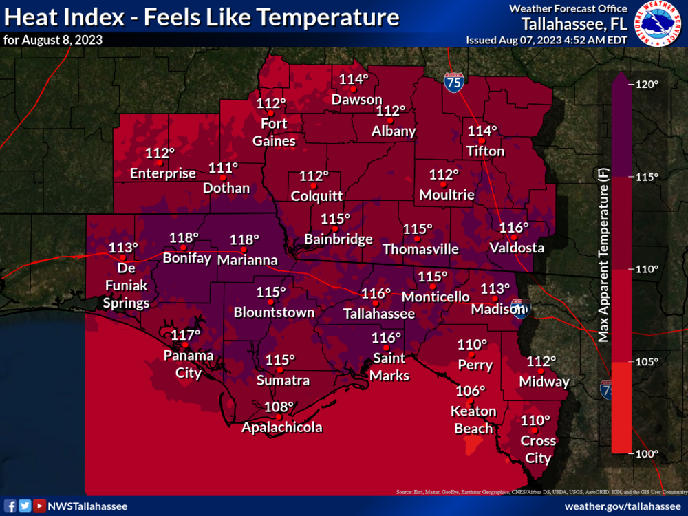
Dangerous heat is expected to persist across the entire tri-state region into at least early next week. For today, an Excessive Heat Warning is posted for our FL counties, southeast AL counties, and southernmost southwest GA counties, where heat index/apparent temperature values will top out between 110 and 115 degrees. The rest of the area in Southwest GA, is under a Heat Advisory, where the heat index will top out between 108 and 112 degrees. The highest values are expected from late this morning through early this evening. The heat continues across the entire region on Tuesday, with the highest heat index values (at or above 115 degrees) currently expected across the FL Panhandle counties, an Excessive Heat Watch is in effect for the entire region.
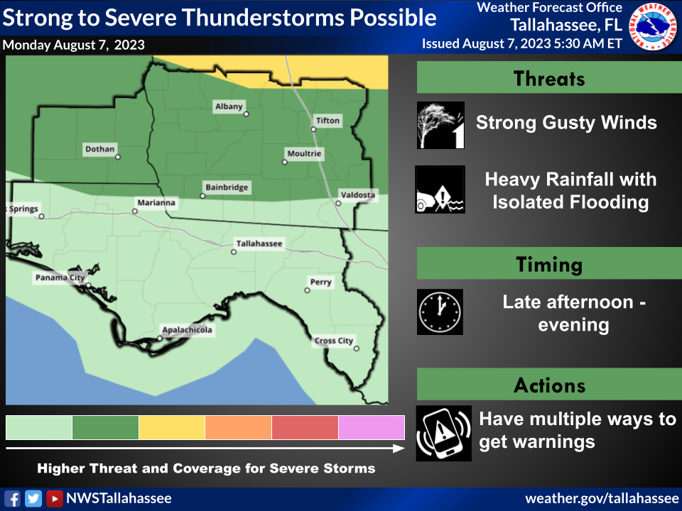
There is also the potential for isolated strong to severe thunderstorms today and more widespread on Tuesday, during the afternoon and evening hours. Isolated damaging wind gusts in excess of 50 mph are the main threat each day, and small hail cannot be ruled out. The Storm Prediction Center has placed portions of the region in a Marginal Risk (Level 1 of 5) for severe weather today and portions of the region within a Slight Risk (Level 2 of 5) on Tuesday.
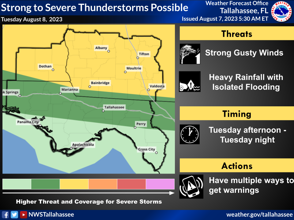
With a very moist air mass in place, slow moving storms will be capable of very heavy rainfall, leading to poor drainage flooding. Isolated rainfall amounts in excess of 3 inches are possible, and if this amount of rain falls in a short period of time, isolated flash flooding is possible.

