Bottom Line:
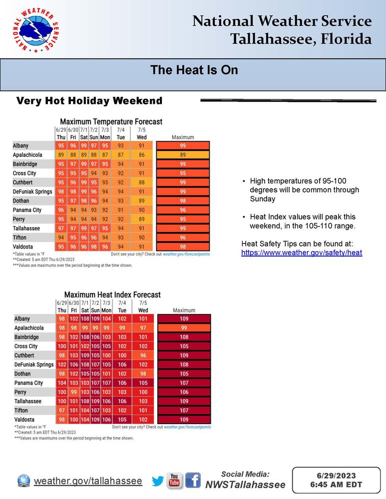
Heading into the holiday weekend, the air mass will get even hotter and muggier. For most communities, the highest heat index values are expected on Saturday and Sunday, with heat index values of 105-110 common. Thunderstorm chances will also increase, with potential for isolated damaging wind gusts.
Overview:
Well above normal temperatures are expected through this weekend. Most communities will see temperatures reach the upper 90s, and 100+ degree readings are in the range of possibilities.
The air mass will get increasingly muggy through the weekend as well. When the effect of temperature and dewpoint are combined into a feels-like heat index value, most places will have their hottest heat index values on Saturday and Sunday. Heat index values of 105-110 will be common. Heat Advisories may eventually be needed on Saturday and Sunday.
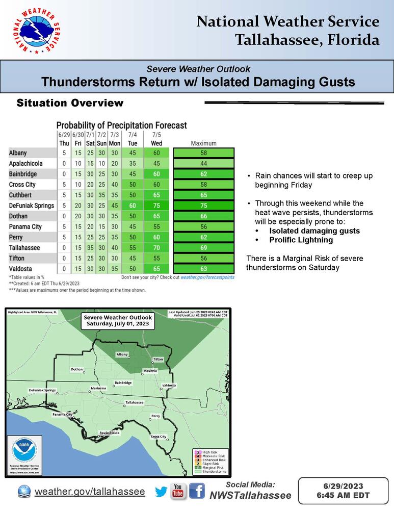
The weather has been dry for most folks since this past Monday, but thunderstorm chances will start to creep up beginning Friday. Through this weekend, any thunderstorms will be prone to isolated damaging wind gusts and prolific lightning. The Storm Prediction Center has outlooked a Marginal Risk of severe thunderstorms on Saturday for some of our Georgia counties, mainly north of Moultrie.