Bottom Line:
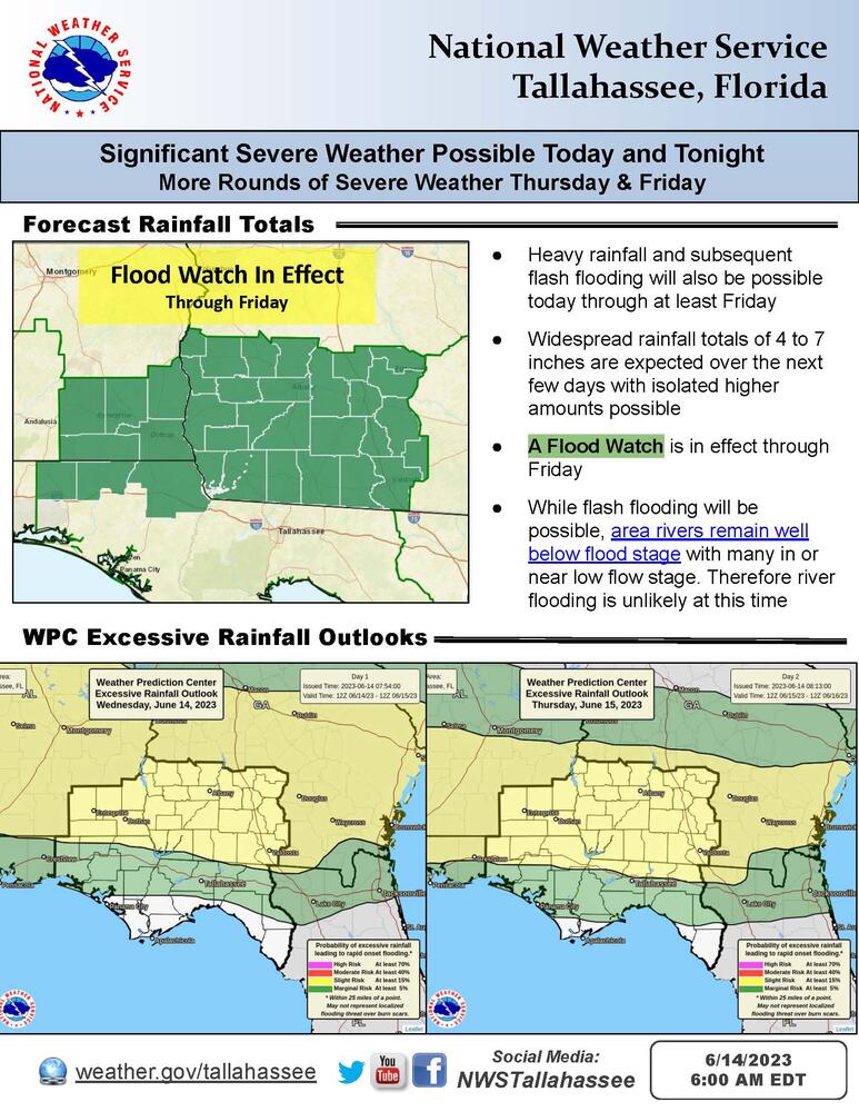
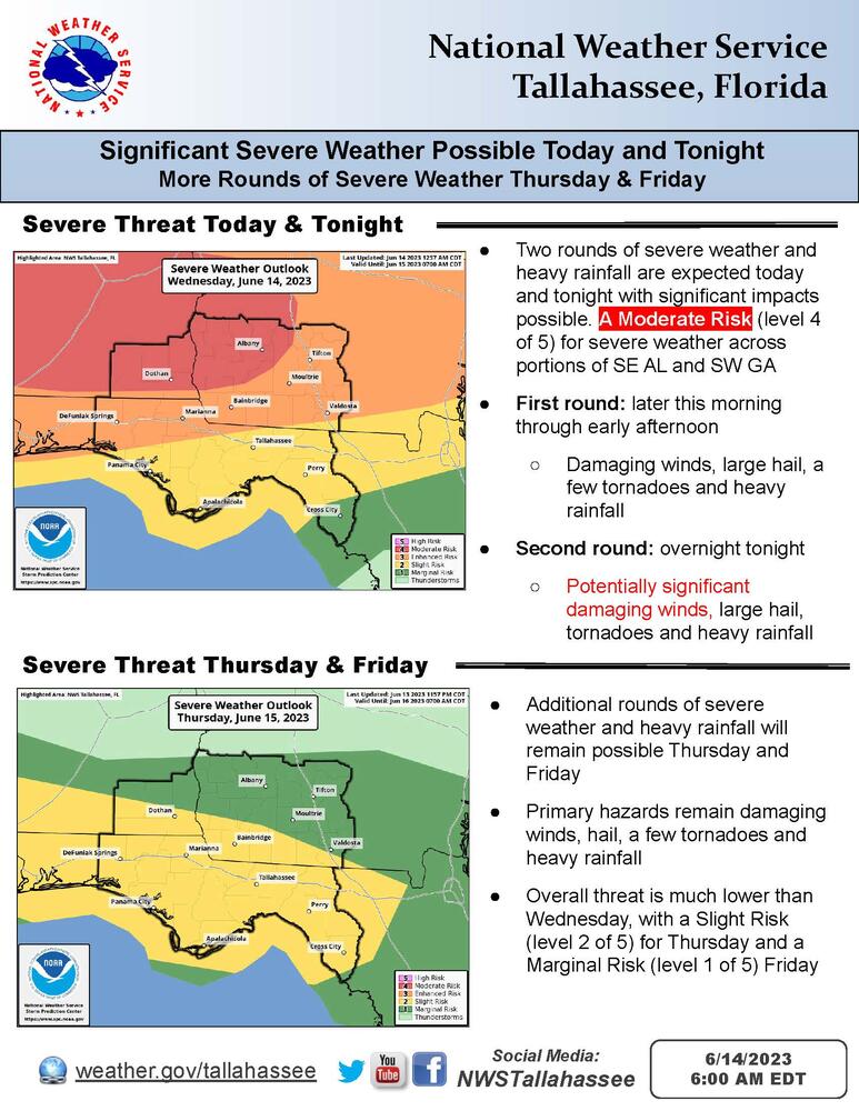
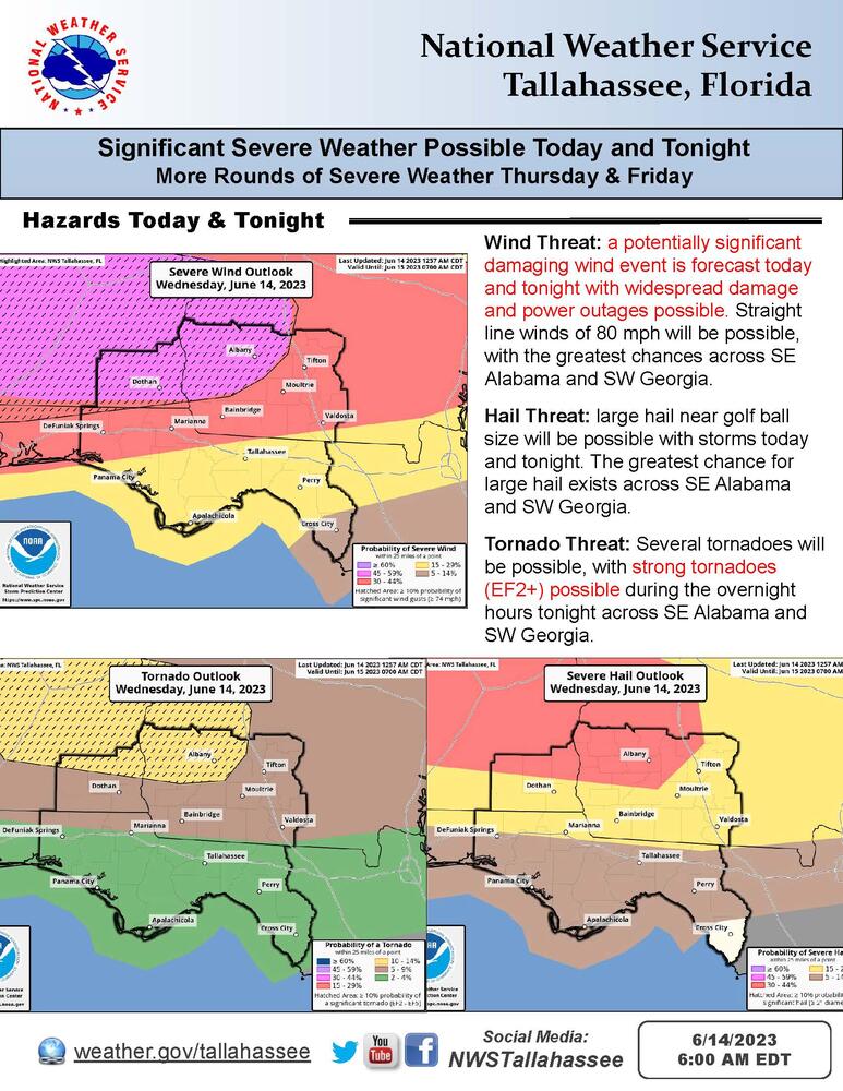
A significant severe weather and heavy rainfall event is possible today and tonight with damaging winds near 80 mph, large hail, tornadoes, and flash flooding all possible. A Moderate Risk (level 4 of 5) for severe weather exists across portions of Southeast Alabama and Southwest Georgia. A Flood Watch has been issued for Southeast Alabama, Southwest Georgia, and portions of the Florida Panhandle.
Overview:
Two rounds of potentially significant severe weather will be possible today and tonight. The first round is expected later this morning into early afternoon with the second, potentially worse round overnight tonight into early Thursday morning. Damaging winds near 80 mph, large hail, tornadoes (some strong), and flash flooding will all be possible.
Additional rounds of severe weather and heavy rainfall will be possible Thursday and Friday as well. Please see the attached briefing for more detailed information.