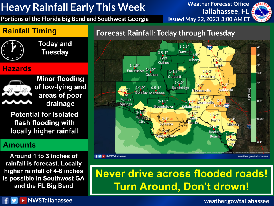
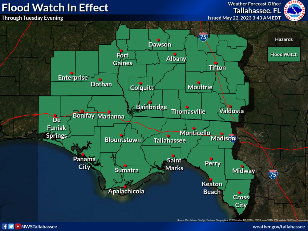
Bottom Line:
Several rounds of showers and storms are expected over the next two days with heavy rainfall and isolated flash flooding possible. A Flood Watch has been issued for the area through Tuesday evening.
Overview:
Unseasonably wet and rainy conditions are forecast over the next couple of days with a stalled front draped across the region. Several rounds of showers and thunderstorms are expected over the next two days, with 2-day widespread rainfall totals of 1 to 3 inches and isolated amounts of 4 to 6 inches possible. Soils across the area are already fairly saturated from heavy rain over the past week. Therefore, additional heavy rainfall may lead to flash flooding, particularly in urban and poor drainage areas. While the best threat for heavy rainfall exists over the Florida Big Bend and I-75 corridor through Georgia, all of the area has at least some potential for heavy rainfall. Therefore a Flood Watch has been issued for the entire area.
Heavy rainfall that falls today will help further prime already moist soils for additional heavy rainfall Tuesday. A few storms may also be strong with gusty winds, small hail and lightning.

