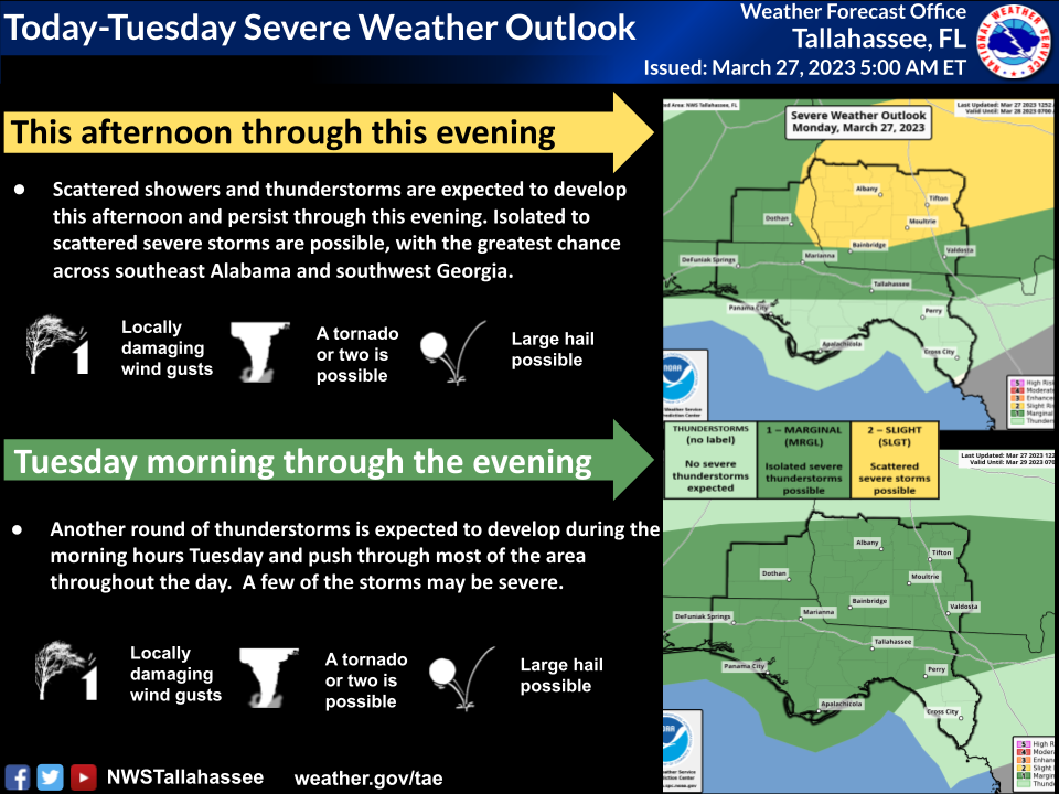
Bottom Line:
There remains a Slight Risk of severe thunderstorms (level 2 of 5) across southwest Georgia and a small part of southeast Alabama with a Marginal Risk (level 1 of 5) across the Florida Panhandle, Big Bend and most of southeast Alabama today. Large hail and damaging winds are the primary threats, but a brief tornado or two cannot be ruled out. Another round of strong to possibly severe storms will move through on Tuesday. Localized heavy rain is also possible.
Overview:
A stationary front currently over central Alabama and central Georgia will move southward into southern Alabama and southern Georgia. Showers and thunderstorms will develop along and ahead of the front, and a few storms may be severe with large hail and damaging winds. While the tornado risk is a bit lower, it is non-zero, and a tornado or two cannot be ruled out.
For Tuesday, the cold front will sink into the Florida counties. As it does so, another round of showers and thunderstorms will move through the area with a marginal risk of damaging wind gusts and perhaps a tornado or two.
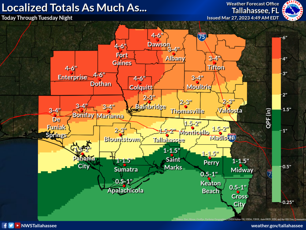
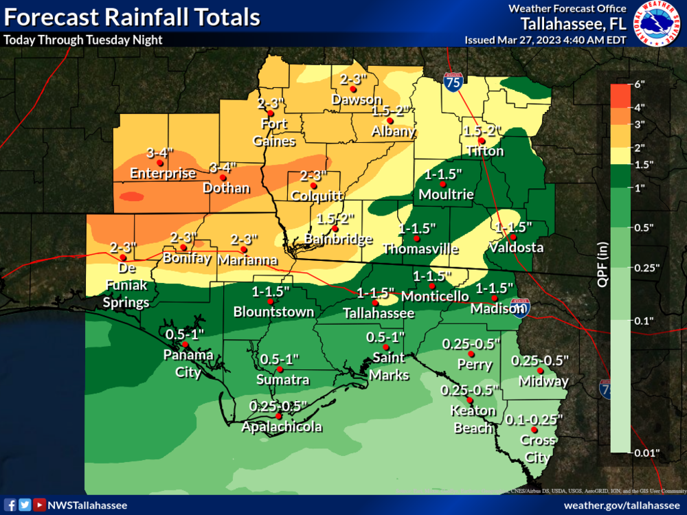
Widespread rainfall totals through Tuesday night will be around 2 to 4 inches across portions of southeast Alabama and southwest Georgia with lesser amounts elsewhere. However, should storms begin training, localized totals of greater than 4 inches are not out of the question. Totals this high could result in a localized flash flood risk. There is a Marginal Risk of excessive rainfall both today and Tuesday across the area.

