Bottom Line:
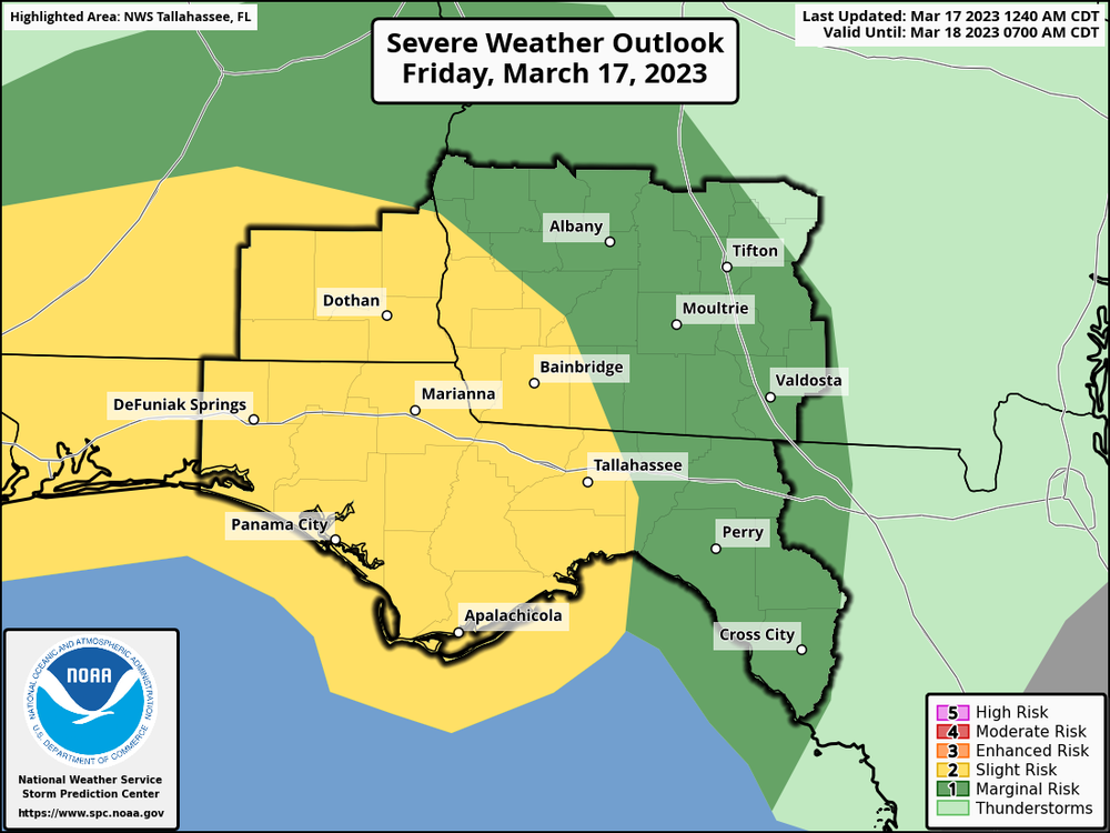
Showers and thunderstorms are expected Friday afternoon through the overnight hours. The Storm Prediction Center has highlighted the Florida Panhandle, west Big Bend, Southeast Alabama, and Southwest Georgia in a Slight Risk for severe weather, with a Marginal Risk across South-central Georgia and the eastern Florida Big Bend. The main threat appears to be damaging wind gusts and a brief tornado or two.
Overview:
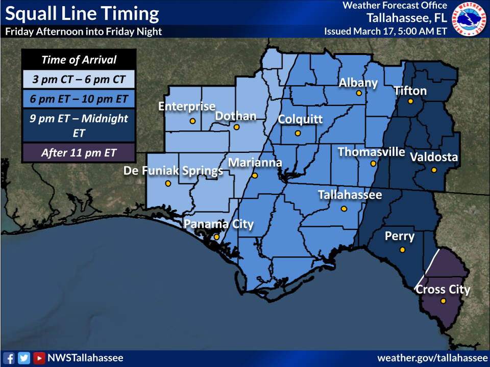
A strong cold front will be making its way through the Gulf Coast states today and tonight accompanied by a line of showers and thunderstorms. Conditions will support strong to severe thunderstorm development with damaging wind gusts being the main threat. However, a couple of tornadoes cannot be ruled out as well. The approximate timing of the line of storms is shown below.
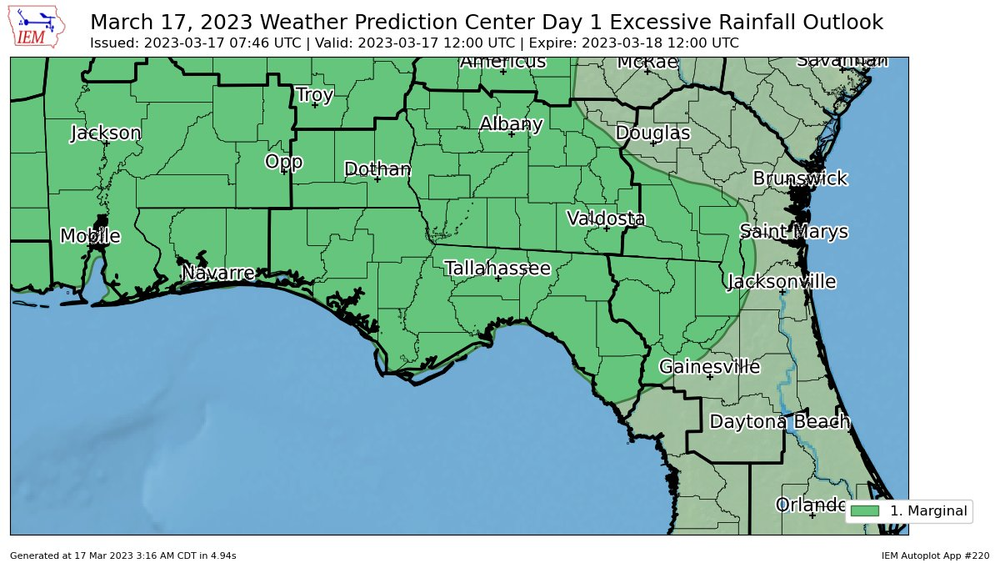
The Weather Prediction Center has also highlighted most of the region in a Marginal (1/4) Risk for Excessive Rainfall. Widespread flooding is not expected with this system, but there could be some localized flooding in low-lying areas Friday into Saturday.

