Changes from the previous briefing:
The Storm Prediction Center (SPC) has removed the Slight Risk (level 2 of 5) from our region. A Marginal Risk (level 1 of 5) now covers our GA, AL, and northern FL counties down to Panama City and Perry. This risk should occur after 7AM EST on Friday.
Bottom Line:
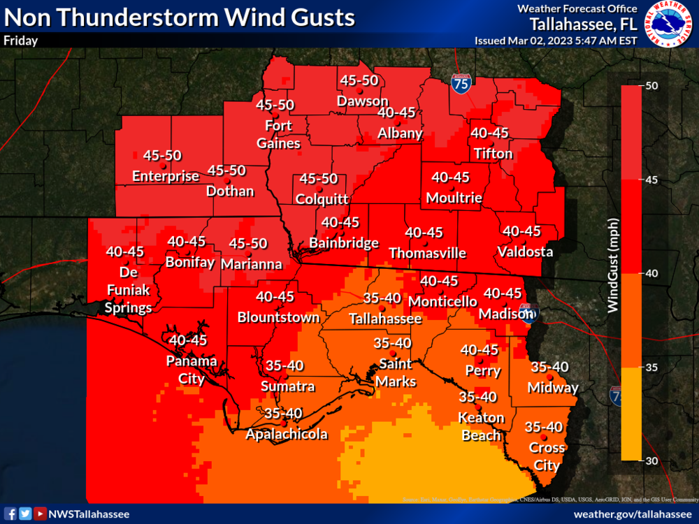
The risk for severe weather exists Friday; However, it will be conditional on whether or not thunderstorms are able to develop. Strong non-thunderstorm wind gusts of 30 to 50 mph are probable. Beach and boating conditions rapidly deteriorate on Friday. Minor coastal flooding is possible.
Overview:
The threat for severe exists; however, it is limited due to a lack of forcing. This means we may not see as widespread or robust of shower or thunderstorm development with the passage of the cold front. Should we get any thunderstorms that do develop, ingredients are favorable for damaging wind gusts and perhaps a tornado or two. The front will slowly trek through the region, exiting the SE Big Bend late Friday into early Saturday morning. Confidence is low for severe weather.
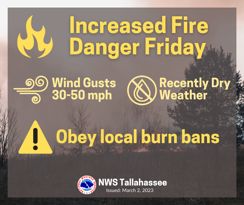
In addition to severe weather, we can expect strong non-thunderstorm related winds. The current forecast calls for sustained wind speeds of 20-30 mph with 40+ mph gusts. Damaging wind gusts may lead to downed trees and branches, possible downed power lines, and difficult driving conditions. Winds will also lead to deteriorating beach and boating conditions. Confidence is high for strong winds.

