Good morning,
Bottom Line: Warm, dry and breezy conditions are expected today. Severe weather potential increases Thursday through Friday.
Overview:
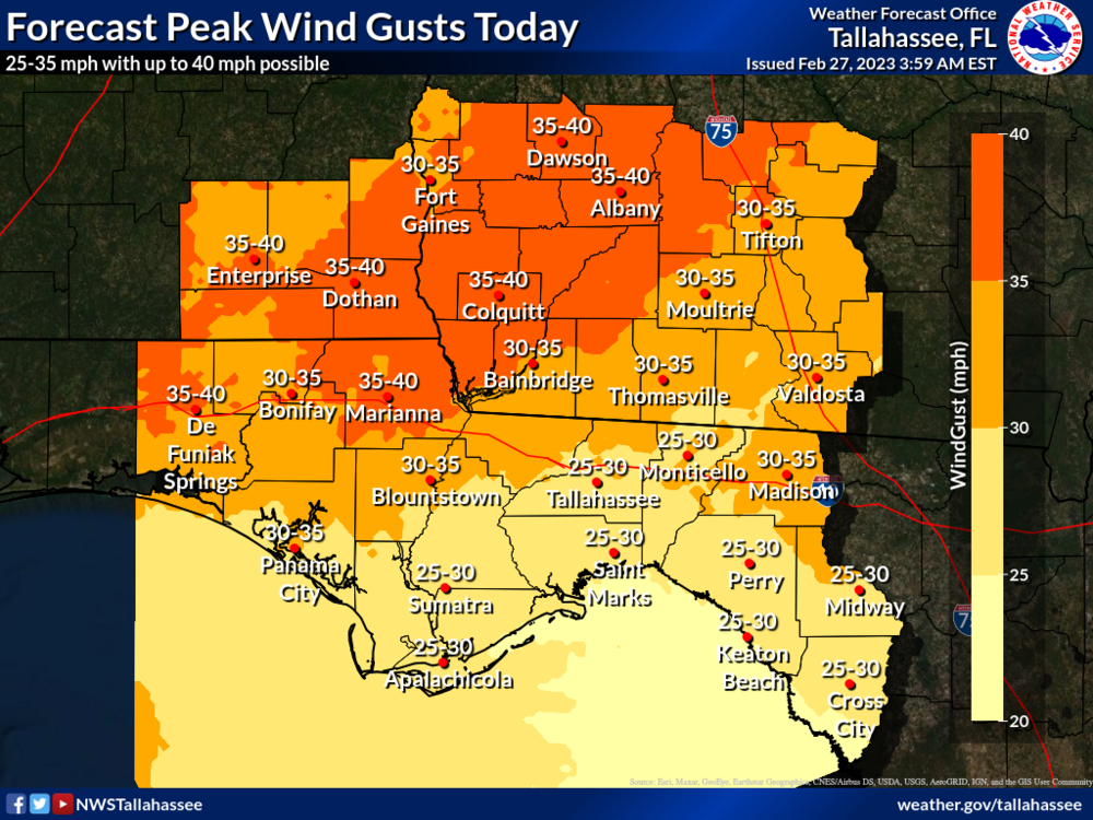
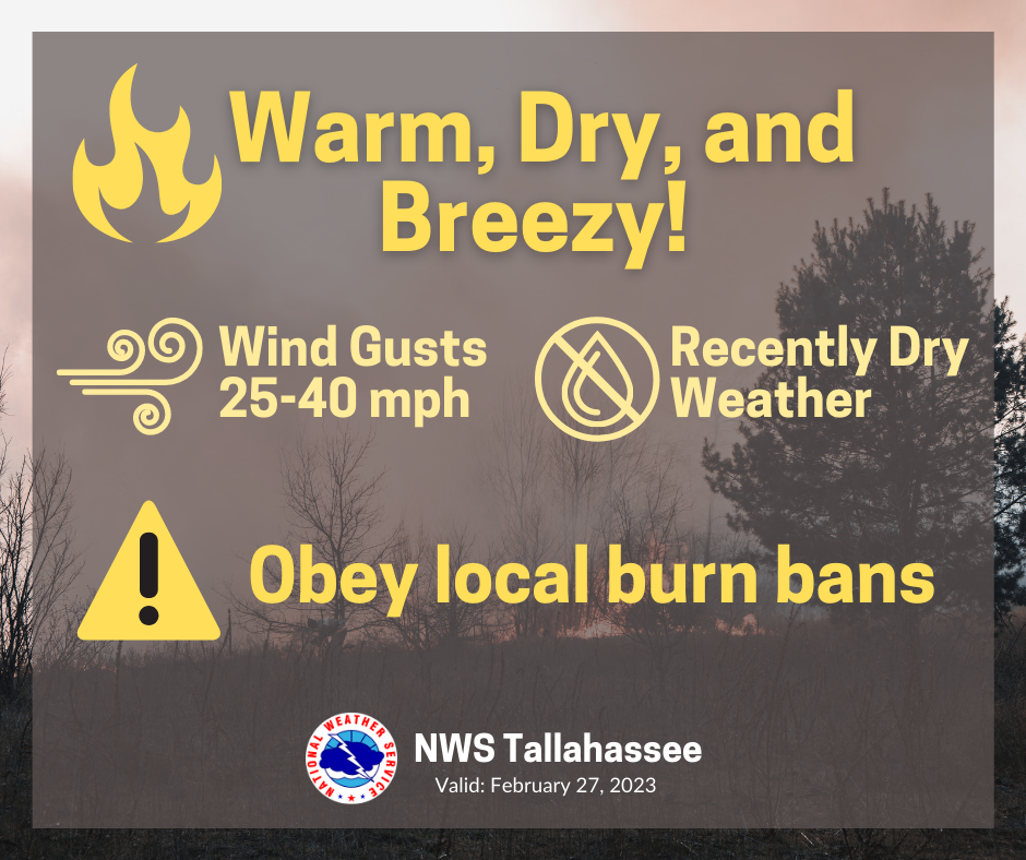
Today - winds become gusty in response to a storm system passing to our northwest. Forecast peak gusts this afternoon are generally 25-35 mph with occasional gusts up to 40 mph. These conditions combined with warm temperatures and continued dry weather will make for elevated fire danger such that any burns may easily spread.
Thu-Fri - a dynamic low-pressure system moving through the Ohio-Tennessee Valley will pose a severe weather threat to us sometime between Thursday and Friday. Storms likely organize into a line that plows through the Tri-state area. All severe hazards appear possible, but damaging winds and tornadoes are the primary threats. In addition to severe weather, we can expect strong non thunderstorms related winds. The current forecast calls for sustained wind speeds of 20-25 mph with 40+ mph gusts.
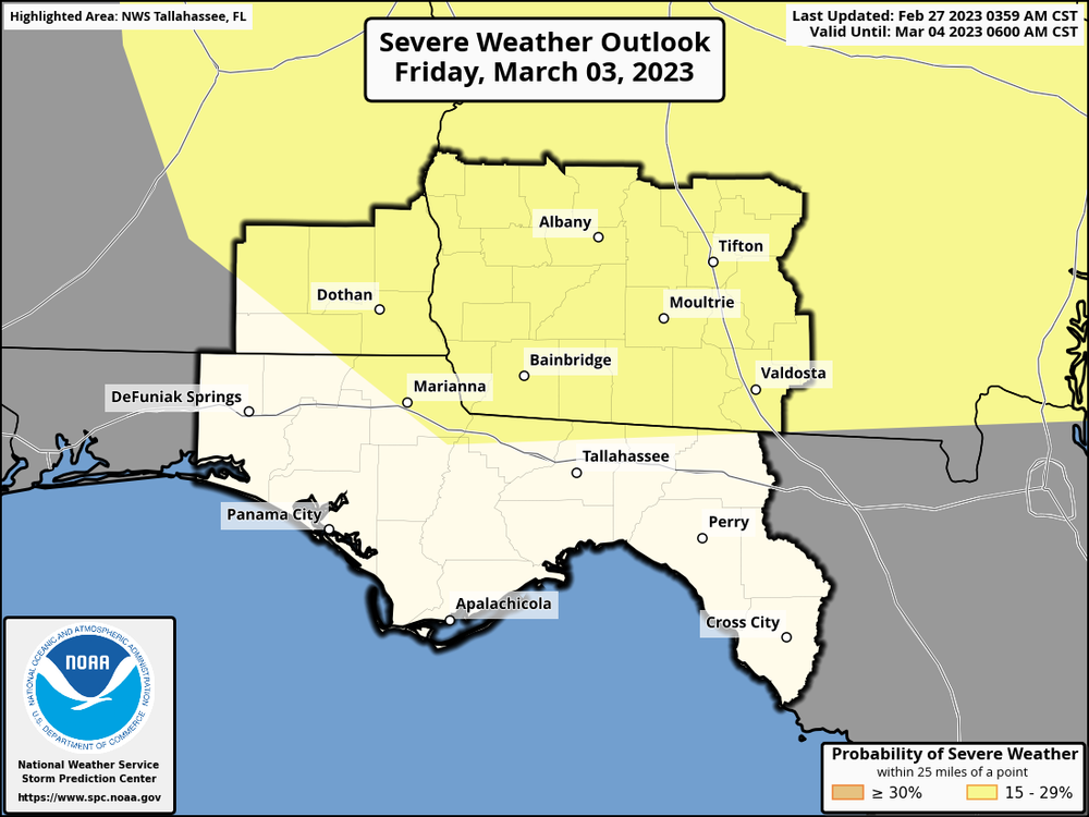
The Storm Prediction Center highlights locations mainly along and north of Interstate-10 on the Day 5 Convective Outlook - valid Friday March 3rd. A risk introduction this far out implies decently high confidence in severe weather potential. Please stay tuned for future updates as the forecast and outlooks become more refined.

