Good Morning,
Changes Since Last Briefing:
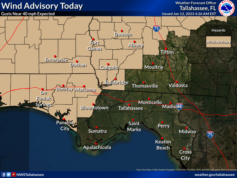
Both the Slight Risk and Marginal Risk areas have expanded eastward and southward. In addition, a wind advisory has been posted for this afternoon for portions of the area for wind gusts near 40 mph well ahead of the line of storms.
Bottom Line:
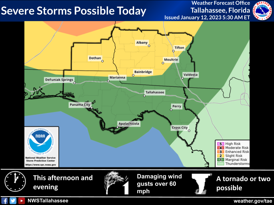
There is a Slight Risk (Level 2 of 5) of severe thunderstorms this afternoon and evening, mainly along and west of a line from northern Walton county to Bainbridge to Moultrie to Fitzgerald.
A Marginal Risk (Level 1 of 5) extends south and east from there to Dixie county.
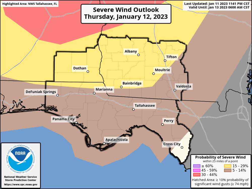
A wind advisory extends roughly along a line from Panama City to Bainbridge to Fitzgerald and westward for gusts near 40 mph well ahead of the line of thunderstorms this afternoon.
Damaging wind gusts are the main threat. However, a tornado or two cannot be ruled out, primarily in the slight risk area. Some hail is also possible.
Overview:
- When: This afternoon and evening.
- What: A line of strong to possibly severe thunderstorms will move east-southeast across the region. The line of storms will gradually weaken as it moves out of the Slight Risk area this evening. Damaging wind gusts are the main threat, but a tornado or two cannot be ruled out along with some hail.
- Where: Slight Risk area located mainly along and west of a line from northern Walton county to Bainbridge to Moultrie to Fitzgerald.