The National Weather Service has issued a Tornado Watch in effect until 2pm this afternoon for the following areas in South Central Georiga:
Tift, Ben Hill, Berrien, Brooks, Colquitt, Cook, Irwin, Lanier, Lowndes & Thomas Counties.
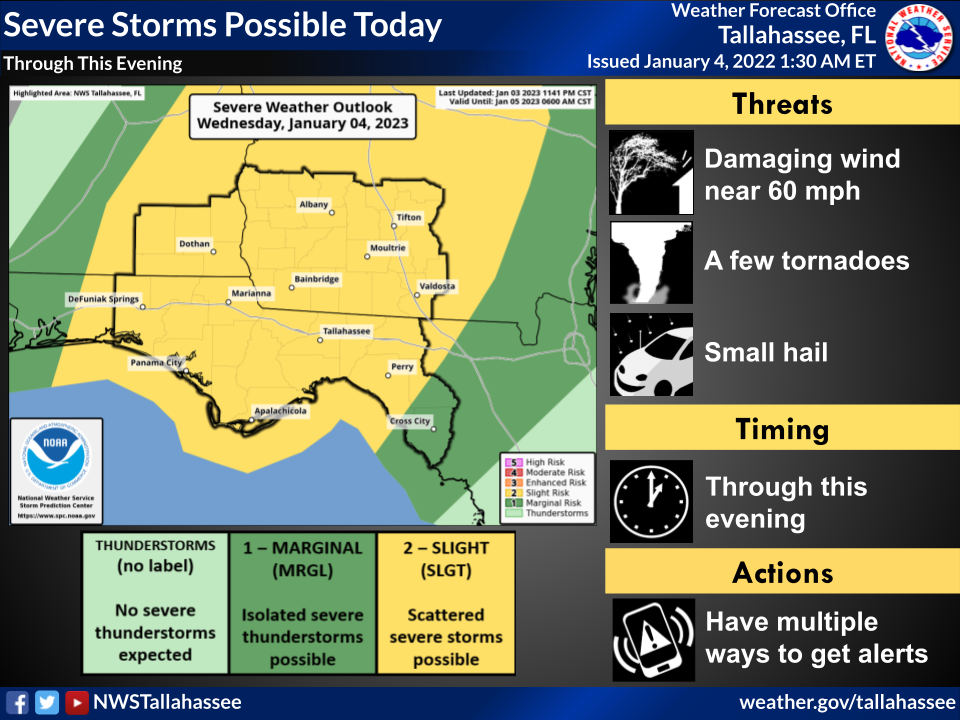
Bottom Line:
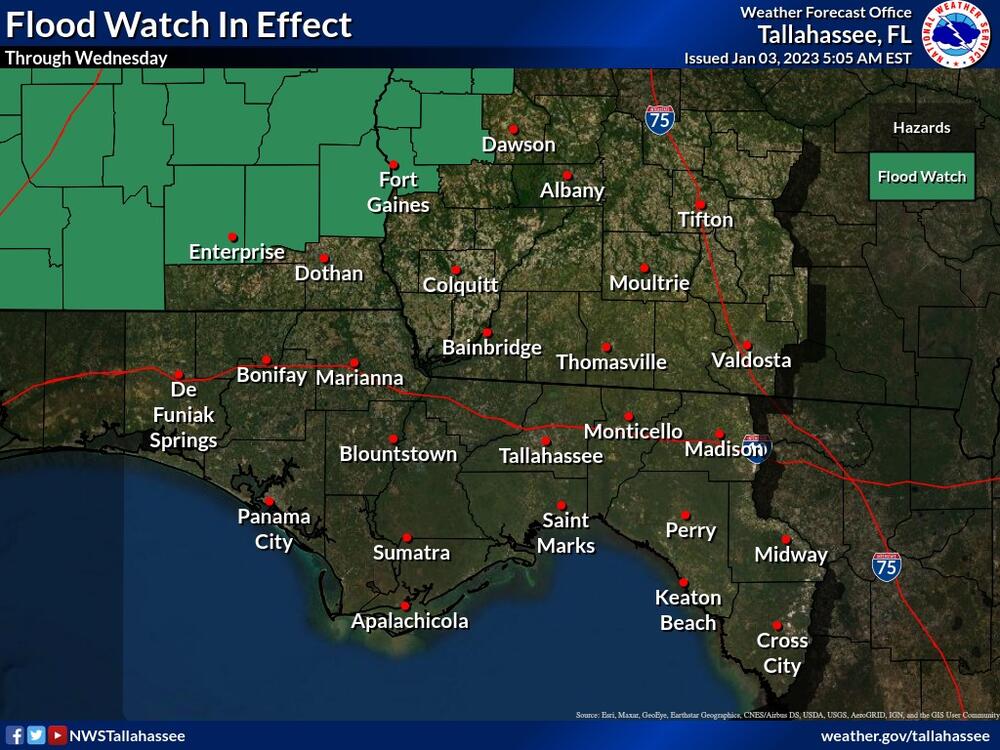
Severe weather will be possible today with damaging winds, tornadoes, hail, and heavy rainfall all possible. A Flood Watch remains in effect for portions of SE Alabama and SW Georgia.
Overview:
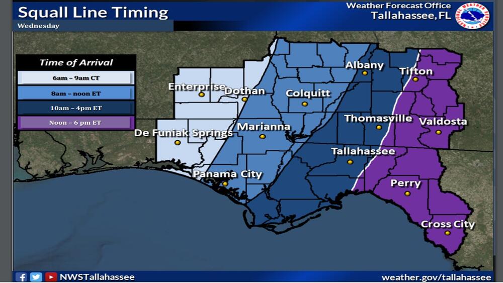
A line of strong to severe thunderstorms is expected to impact our area beginning in the predawn hours in southeast Alabama and the western Florida panhandle then spread eastward through the remainder of the area today. This line is associated with a cold front which will slowly push through the area by Thursday morning. Given the atmospheric environment early this morning, damaging winds, tornadoes, hail, and isolated heavy rainfall will be possible with these storms. A Flood Watch has been issued for Coffee, Dale, and Henry counties in SE Alabama as well as Clay, Quitman, and Randolph counties in SW Georgia. While these counties have a higher likelihood of heavy rainfall, isolated pockets of heavy rainfall are possible area-wide.