Bottom Line:
All tropical storm watches are now tropical storm warnings and the extent of warnings has expanded north and west, additional expansions north and west can't be ruled out later today, especially if small west trends continue. The Storm Surge Watch remains unchanged for the possibility of 2-4ft of storm surge inundation. The likelihood we observe these values will increase with any westward shifts that brings Nicole into the Gulf. A track inland up the Florida Peninsula would lower the threat for storm surge. Surge potential will be highest Thursday night into Friday morning.
Overview:
1. Nicole is expected to strengthen into a hurricane by Wednesday morning. Nicole is forecast to reach the Florida east coast late Wednesday night or early Thursday morning.
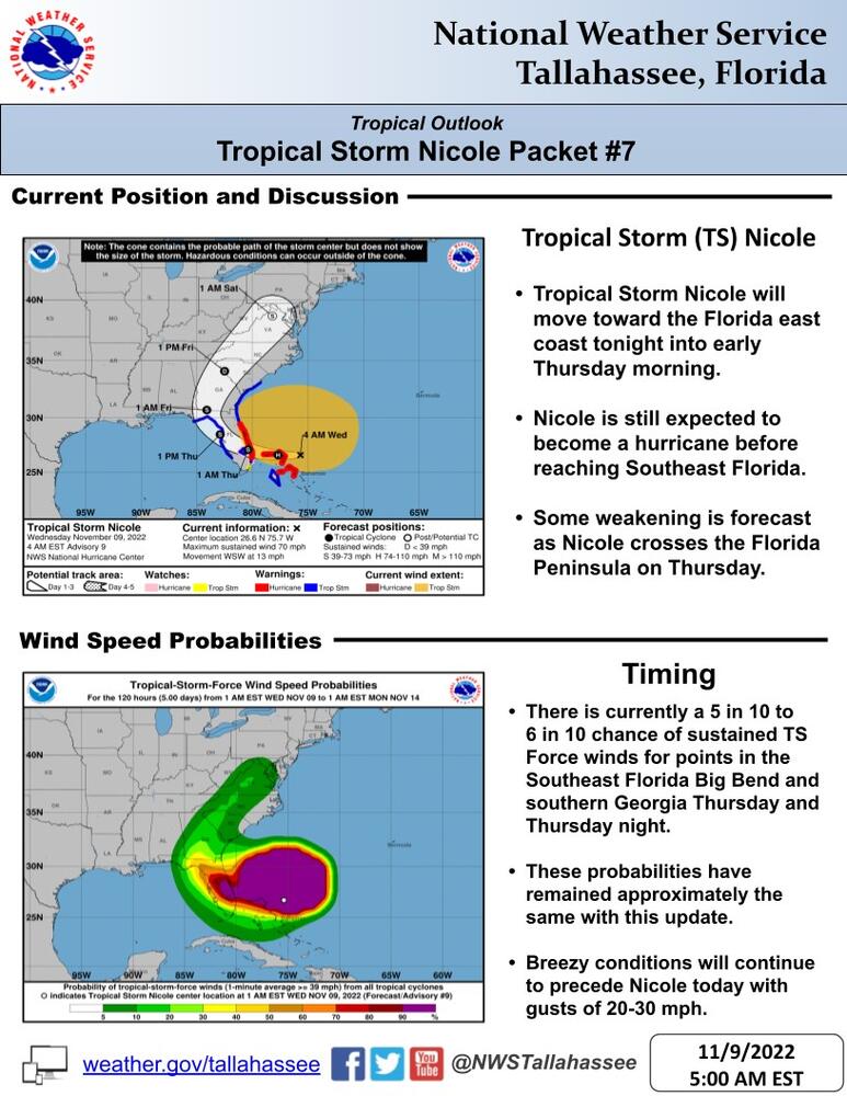
2. There is currently a 5 in 10 to 6 in 10 chance of sustained TS Force winds for points in the Southeast Florida Big Bend and southern Georgia Thursday and Thursday night. These probabilities have remained approximately the same with this update.
3. While tropical storm force winds could begin as early as Wednesday night along the Florida big bend coast, they are most likely to begin on Thursday. In addition, breezy conditions with gusts of 20-30 mph are forecast for Wednesday.
4. Storm surge impacts will depend heavily on the track of the system. A track farther west could increase impacts for Apalachee Bay, while a track further east would result in offshore flow with minimal surge impacts.
5. While some localized heavy rainfall amounts could occur, the recent dry conditions is expected to limit the threat for significant flooding. However, heavy rain rates due to Nicole will lead to a potential for localized flooding. Rainfall amounts will generally be around 2 to 4 inches east of the Apalachicola/Chattahoochee rivers with localized higher amounts. Lesser amounts are forecast west of the Apalachicola/Chattahoochee Rivers.

