Bottom Line:
A couple rounds of strong to severe storms today, beginning late this morning and continuing into the late evening. Chances for strong to severe storms continue both Friday and Saturday. Locally heavy rainfall could lead to some localized flash flooding each day through Sunday.
Overview:
Several rounds of severe weather and heavy rainfall are possible as a front moves slowly through the area.
Today (Thursday)
- A large complex of showers and storms is forecast to develop near the Panhandle later this morning/around midday before moving northeastward through the area through the early afternoon. Another, more organized line of showers and thunderstorms is forecast to push into the area from the west in the early to mid afternoon before moving eastward through the area into the evening.
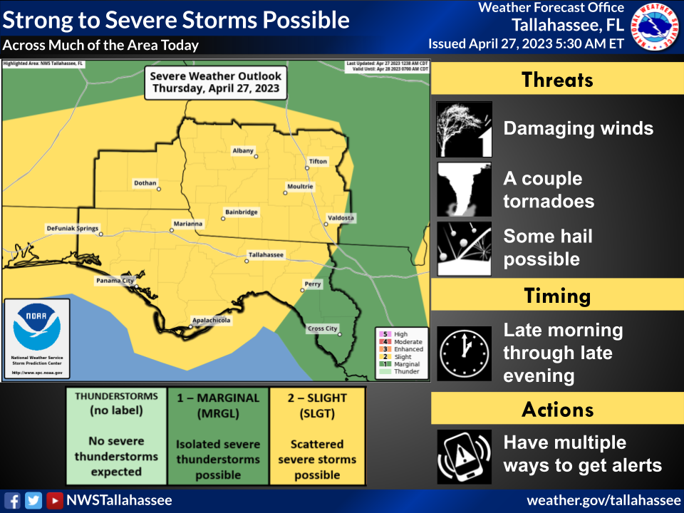
- Strong to severe thunderstorms will be possible with all activity today, with tornadoes, damaging winds, hail, and heavy rainfall possible.
- Slight Risk (level 2 of 5) for severe weather.
- Timing - First round may begin in the late morning to midday across the FL Panhandle and SE AL, reaching the FL Big Bend into SW GA in the early to mid afternoon hours. The second round is forecast to push into SE AL and the FL Panhandle around mid afternoon, reaching the FL BIg Bend and SW GA in the early evening hours and lingering into the late evening. Since there will probably be at least two waves of storms today, exact onset and ending timing is difficult to parse out.
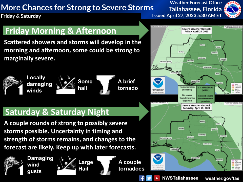
Friday
- Scattered thunderstorms will redevelop early in the morning near the coast and offshore and gradually move into the Big Bend in the morning. Additional storms could develop in southwest Georgia along the cold front.
- Primary threats include locally damaging wind gusts, some hail, a brief tornado, and heavy rainfall.
- Marginal Risk (level 1 of 5) for severe weather.
Saturday
- A stronger system will move across the area through the day Saturday with possibly a couple rounds of strong to severe storms and heavy rainfall.
- Uncertainty is a bit higher with this system, but this has a higher ceiling than today's severe weather with some better ingredients possible.
- Marginal Risk (level 1 of 5) for severe weather, but could change in later forecasts.
Slight Risk for (level 2 of 4) excessive rainfall.
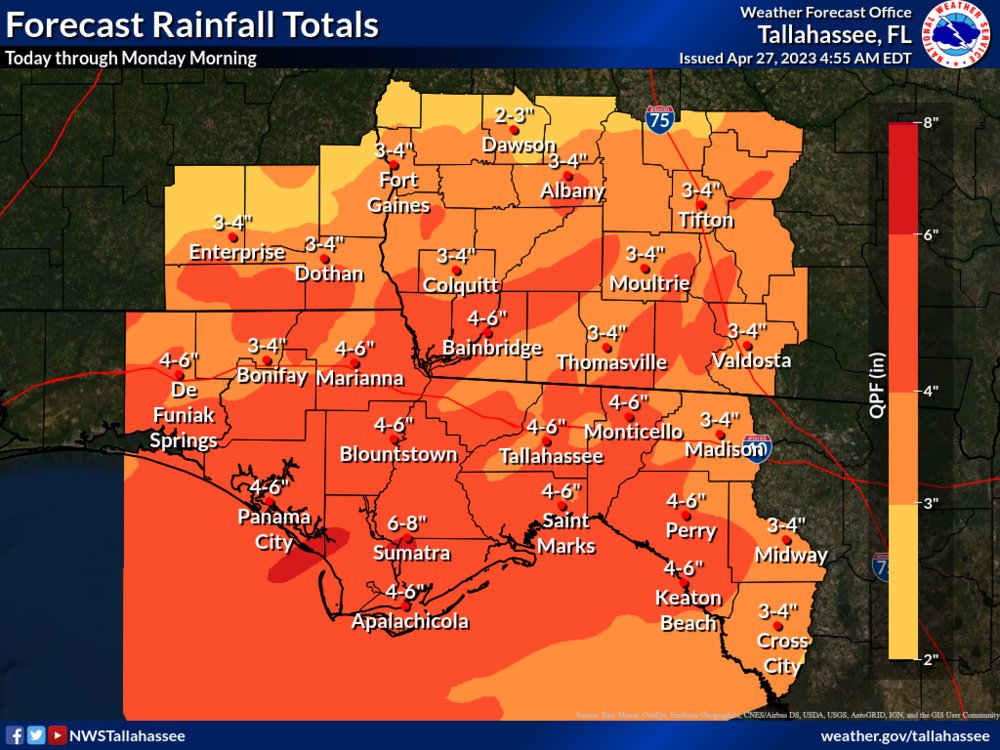
Through the weekend, rainfall totals of 3 to 6 inches with localized totals of 8 inches or more are expected. Localized flash flooding is possible.